Champsecret geodata
Champsecret (Normandy) is a populated place; located in France in Europe/Paris (GMT+2) time zone. With population of 1,055 people, there are 8433 cities with bigger population in this country. Compared to other cities in France, 71.1% of cities are located further ↓South; 84% of cities are located further →East and 68.8% of cities have lower elevation than Champsecret. Note1
Administrative division(s):
- Level 1: Normandy
- Level 2: Département de l'Orne
- Level 3: Argentan
- Level 4: Champsecret


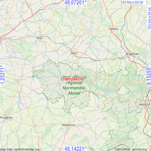
Champsecret GPS coordinates[2]
48° 36' 33.3" North, 0° 33' 2.088" West
| Map corner | latitude | longitude |
|---|---|---|
| Upper-left | 49.07201°, | -1.25371° |
| Center: | 48.60925°, | -0.55058° |
| Lower-right: | 48.14221°, | 0.15255° |
| Map W x H: | 103.4×103.4 km | = 64.2×64.2mi |
| max Lat: | 51.07786° ⇑28.9% North |
| Champsecret: | 48.60925° |
| min Lat: | ⇓71.1% South 41.3874° |
| min Long | Champsecret | max Long |
| -5.08615° | -0.55058° | 9.52242° |
| W 16%⇐ | ⇒84% E |
Elevation
Elevation of Champsecret is 213 m = 699 ft, and this is 19.3 m = 63 ft above average elevation for this country.
| Max E: |
2333 m = 7654 ft | 31.2% |
| Champsecret | 213 m 699 ft | |
| Avg. | 193.7 m = 635 ft | |
Min E: |
-1 m = -3 ft | 68.8% |
See also: France elevation on elevation.city.
Geographical zone
Champsecret is located in North temperate zone (between Tropic of Cancer and the Arctic Circle). Distance of this North polar circle is 1996.3 km =1240.4 mi to North.| Distance of | km | miles | from Champsecret |
|---|---|---|---|
| North Pole | 4602.2 | 2859.7 | to North |
| Arctic Circle | 1996.3 | 1240.4 | to North |
| Tropic Cancer | 2798.9 | 1739.2 | to South |
| Equator | 5404.8 | 3358.4 | to South |


Nearby cities:
15 places around Champsecret: (largest is in red/bold)
• Bagnoles-de-l'Orne
11.6 km =7.2 mi,  119°
119°
• Bellou-en-Houlme
12 km =7.5 mi,  41°
41°
• Domfront
7.3 km =4.5 mi,  254°
254°
• Juvigny-sous-Andaine
7.1 km =4.4 mi,  154°
154°
• La Chapelle-au-Moine
11.3 km =7 mi,  347°
347°
• La Coulonche
8.1 km =5 mi,  58°
58°
• La Ferrière-aux-Étangs
6.3 km =3.9 mi,  21°
21°
• La Haute-Chapelle
8.8 km =5.5 mi,  267°
267°
• La Sauvagère
10 km =6.2 mi,  80°
80°
• Messei
11.4 km =7.1 mi,  4°
4°
• Saint-André-de-Messei
9.7 km =6 mi,  11°
11°
• Saint-Bômer-les-Forges
7.2 km =4.5 mi,  302°
302°
• Saint-Clair-de-Halouze
9.6 km =6 mi,  324°
324°
• Saint-Maurice-du-Désert
11.9 km =7.4 mi,  89°
89°
• Tessé-la-Madeleine
11.4 km =7.1 mi,  125°
125°
Sources, notices
• [Note1] Compared only with cities in France existing in our database
• [Src1] Map data: © OpenStreetMap contributors (CC-BY-SA)
• [Src2] Other city data from geonames.org with taken over terms of usage.
• [Src3] Geographical zone / Annual Mean Temperature by Robert A. Rohde @ Wikipedia
