La Ferrière-aux-Étangs geodata
La Ferrière-aux-Étangs (Normandy) is a populated place; located in France in Europe/Paris (GMT+2) time zone. With population of 1,694 people, there are 5540 cities with bigger population in this country. Compared to other cities in France, 72.3% of cities are located further ↓South; 83.7% of cities are located further →East and 77.6% of cities have lower elevation than La Ferrière-aux-Étangs. Note1
Administrative division(s):
- Level 1: Normandy
- Level 2: Département de l'Orne
- Level 3: Argentan
- Level 4: La Ferrière-aux-Étangs
Current local time in La Ferrière-aux-Étangs:
05:59 AM, WednesdayDifference from your time zone: hours


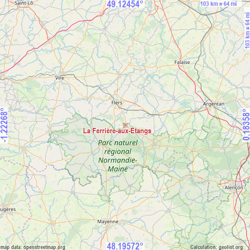
La Ferrière-aux-Étangs GPS coordinates[2]
48° 39' 44.172" North, 0° 31' 10.38" West
| Map corner | latitude | longitude |
|---|---|---|
| Upper-left | 49.12454°, | -1.22268° |
| Center: | 48.66227°, | -0.51955° |
| Lower-right: | 48.19572°, | 0.18358° |
| Map W x H: | 103.3×103.3 km | = 64.2×64.2mi |
| max Lat: | 51.07786° ⇑27.7% North |
| La Ferrière-aux-Étangs: | 48.66227° |
| min Lat: | ⇓72.3% South 41.3874° |
| min Long | La Ferrière-au | max Long |
| -5.08615° | -0.51955° | 9.52242° |
| W 16.3%⇐ | ⇒83.7% E |
Elevation
Elevation of La Ferrière-aux-Étangs is 269 m = 883 ft, and this is 75.3 m = 247 ft above average elevation for this country.
| Max E: |
2333 m = 7654 ft | 22.4% |
| La Ferrière-aux-Étangs | 269 m 883 ft | |
| Avg. | 193.7 m = 635 ft | |
Min E: |
-1 m = -3 ft | 77.6% |
See also: France elevation on elevation.city.
Geographical zone
La Ferrière-aux-Étangs is located in North temperate zone (between Tropic of Cancer and the Arctic Circle). Distance of this North polar circle is 1990.4 km =1236.8 mi to North.| Distance of | km | miles | from La Ferrière-aux-Étangs |
|---|---|---|---|
| North Pole | 4596.3 | 2856 | to North |
| Arctic Circle | 1990.4 | 1236.8 | to North |
| Tropic Cancer | 2804.8 | 1742.8 | to South |
| Equator | 5410.7 | 3362.1 | to South |


Nearby cities:
15 places around La Ferrière-aux-Étangs: (largest is in red/bold)
• Bellou-en-Houlme
6.5 km =4 mi,  61°
61°
• Briouze
11.8 km =7.3 mi,  70°
70°
• Champsecret
6.3 km =3.9 mi,  201°
201°
• Domfront
12.1 km =7.5 mi,  229°
229°
• Flers
9.3 km =5.8 mi,  334°
334°
• La Chapelle-au-Moine
7 km =4.3 mi,  317°
317°
• La Coulonche
4.9 km =3 mi,  110°
110°
• La Sauvagère
8.7 km =5.4 mi,  119°
119°
• La Selle-la-Forge
8 km =5 mi,  348°
348°
• Messei
5.6 km =3.5 mi, 346°
• Saint-André-de-Messei
3.6 km =2.2 mi,  355°
355°
• Saint-Bômer-les-Forges
8.6 km =5.3 mi,  256°
256°
• Saint-Clair-de-Halouze
8.1 km =5 mi,  283°
283°
• Saint-Maurice-du-Désert
11.2 km =7 mi, 120°
• Saint-Paul
12.2 km =7.6 mi, 316°
Sources, notices
• [Note1] Compared only with cities in France existing in our database
• [Src1] Map data: © OpenStreetMap contributors (CC-BY-SA)
• [Src2] Other city data from geonames.org with taken over terms of usage.
• [Src3] Geographical zone / Annual Mean Temperature by Robert A. Rohde @ Wikipedia
