Donnezac geodata
Donnezac (Nouvelle-Aquitaine) is a populated place; located in France in Europe/Paris (GMT+2) time zone. With population of 840 people, there are 10186 cities with bigger population in this country. Compared to other cities in France, 77% of cities are located further ↑North; 82.7% of cities are located further →East and 80.6% of cities have higher elevation than Donnezac. Note1
Administrative division(s):
- Level 1: Nouvelle-Aquitaine
- Level 2: Gironde
- Level 3: Arrondissement de Blaye
- Level 4: Donnezac


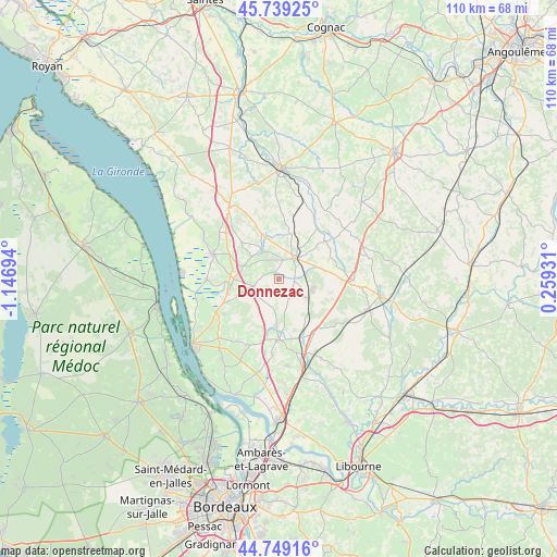
Donnezac GPS coordinates[2]
45° 14' 46.896" North, 0° 26' 37.716" West
| Map corner | latitude | longitude |
|---|---|---|
| Upper-left | 45.73925°, | -1.14694° |
| Center: | 45.24636°, | -0.44381° |
| Lower-right: | 44.74916°, | 0.25931° |
| Map W x H: | 110.1×110.1 km | = 68.4×68.4mi |
| max Lat: | 51.07786° ⇑77% North |
| Donnezac: | 45.24636° |
| min Lat: | ⇓23% South 41.3874° |
| min Long | Donnezac | max Long |
| -5.08615° | -0.44381° | 9.52242° |
| W 17.3%⇐ | ⇒82.7% E |
Elevation
Elevation of Donnezac is 53 m = 174 ft, and this is 140.7 m = 462 ft below average elevation for this country.
| Max E: |
2333 m = 7654 ft | 80.6% |
| Avg. | 193.7 m = 635 ft | |
| Donnezac | 53 m = 174 ft | |
Min E: |
-1 m = -3 ft | 19.4% |
See also: France elevation on elevation.city.
Geographical zone
Donnezac is located in North temperate zone (between Tropic of Cancer and the Arctic Circle). Distance of this North polar circle is 2370.3 km =1472.8 mi to North.| Distance of | km | miles | from Donnezac |
|---|---|---|---|
| North Pole | 4976.1 | 3092 | to North |
| Arctic Circle | 2370.3 | 1472.8 | to North |
| Tropic Cancer | 2425 | 1506.8 | to South |
| Equator | 5030.9 | 3126.1 | to South |


Nearby cities:
15 places around Donnezac: (largest is in red/bold)
• Boisredon
10.6 km =6.6 mi,  315°
315°
• Braud-et-Saint-Louis
14.1 km =8.8 mi,  270°
270°
• Bussac-Forêt
6.9 km =4.3 mi,  123°
123°
• Cartelègue
12.8 km =8 mi,  237°
237°
• Chepniers
11.3 km =7 mi,  87°
87°
• Générac
11 km =6.8 mi,  228°
228°
• Marcillac
6.7 km =4.2 mi,  291°
291°
• Montendre
5.2 km =3.2 mi,  34°
34°
• Reignac
5.1 km =3.2 mi,  254°
254°
• Saint-Aubin-de-Blaye
9.4 km =5.8 mi,  284°
284°
• Saint-Christoly-de-Blaye
13.7 km =8.5 mi,  201°
201°
• Saint-Ciers-sur-Gironde
13.7 km =8.5 mi, 290°
• Saint-Savin
10.7 km =6.6 mi,  182°
182°
• Saint-Yzan-de-Soudiac
12 km =7.5 mi,  167°
167°
• Étauliers
10.3 km =6.4 mi,  257°
257°
Sources, notices
• [Note1] Compared only with cities in France existing in our database
• [Src1] Map data: © OpenStreetMap contributors (CC-BY-SA)
• [Src2] Other city data from geonames.org with taken over terms of usage.
• [Src3] Geographical zone / Annual Mean Temperature by Robert A. Rohde @ Wikipedia
