Saint-Aubin-lès-Elbeuf geodata
Saint-Aubin-lès-Elbeuf (Normandy) is a populated place; located in France in Europe/Paris (GMT+2) time zone. With population of 8,486 people, there are 1142 cities with bigger population in this country. Compared to other cities in France, 86.2% of cities are located further ↓South; 68.7% of cities are located further →East and 96.3% of cities have higher elevation than Saint-Aubin-lès-Elbeuf. Note1
Administrative division(s):
- Level 1: Normandy
- Level 2: Seine-Maritime
- Level 3: Arrondissement de Rouen
- Level 4: Saint-Aubin-lès-Elbeuf
Current local time in Saint-Aubin-lès-Elbeuf:
04:18 AM, WednesdayDifference from your time zone: hours


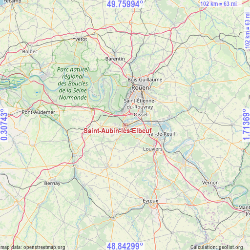
Saint-Aubin-lès-Elbeuf GPS coordinates[2]
49° 18' 12.96" North, 1° 0' 38.016" East
| Map corner | latitude | longitude |
|---|---|---|
| Upper-left | 49.75994°, | 0.30743° |
| Center: | 49.3036°, | 1.01056° |
| Lower-right: | 48.84299°, | 1.71369° |
| Map W x H: | 102×102 km | = 63.4×63.4mi |
| max Lat: | 51.07786° ⇑13.8% North |
| Saint-Aubin-lès-Elbeuf: | 49.3036° |
| min Lat: | ⇓86.2% South 41.3874° |
| min Long | Saint-Aubin-lè | max Long |
| -5.08615° | 1.01056° | 9.52242° |
| W 31.3%⇐ | ⇒68.7% E |
Elevation
Elevation of Saint-Aubin-lès-Elbeuf is 13 m = 43 ft, and this is 180.7 m = 593 ft below average elevation for this country.
| Max E: |
2333 m = 7654 ft | 96.3% |
| Avg. | 193.7 m = 635 ft | |
| Saint-Aubin-lès-Elbeuf | 13 m = 43 ft | |
Min E: |
-1 m = -3 ft | 3.7% |
See also: France elevation on elevation.city.
Geographical zone
Saint-Aubin-lès-Elbeuf is located in North temperate zone (between Tropic of Cancer and the Arctic Circle). Distance of this North polar circle is 1919.1 km =1192.5 mi to North.| Distance of | km | miles | from Saint-Aubin-lès-Elbeuf |
|---|---|---|---|
| North Pole | 4525 | 2811.7 | to North |
| Arctic Circle | 1919.1 | 1192.5 | to North |
| Tropic Cancer | 2876.1 | 1787.1 | to South |
| Equator | 5482 | 3406.4 | to South |


Nearby cities:
15 places around Saint-Aubin-lès-Elbeuf: (largest is in red/bold)
• Caudebec-lès-Elbeuf
2.7 km =1.7 mi,  161°
161°
• Cléon
1.7 km =1.1 mi,  54°
54°
• Criquebeuf-sur-Seine
6.5 km =4 mi,  87°
87°
• Elbeuf
2 km =1.2 mi,  196°
196°
• Freneuse
5.5 km =3.4 mi,  74°
74°
• Grand-Couronne
5.8 km =3.6 mi,  357°
357°
• La Saussaye
5.4 km =3.4 mi, 203°
• Le Bosc-Roger-en-Roumois
6 km =3.7 mi,  248°
248°
• Le Thuit-Anger
4.4 km =2.7 mi,  222°
222°
• Le Thuit-Signol
6.7 km =4.2 mi,  230°
230°
• Moulineaux
5.8 km =3.6 mi,  319°
319°
• Oissel
6.9 km =4.3 mi,  61°
61°
• Saint-Ouen-du-Tilleul
4.6 km =2.9 mi,  261°
261°
• Saint-Pierre-des-Fleurs
6.8 km =4.2 mi,  208°
208°
• Saint-Pierre-lès-Elbeuf
3.6 km =2.2 mi,  139°
139°
Sources, notices
• [Note1] Compared only with cities in France existing in our database
• [Src1] Map data: © OpenStreetMap contributors (CC-BY-SA)
• [Src2] Other city data from geonames.org with taken over terms of usage.
• [Src3] Geographical zone / Annual Mean Temperature by Robert A. Rohde @ Wikipedia
