Grand-Couronne geodata
Grand-Couronne (Normandy) is a populated place; located in France in Europe/Paris (GMT+2) time zone. With population of 9,569 people, there are 991 cities with bigger population in this country. Compared to other cities in France, 87.1% of cities are located further ↓South; 68.7% of cities are located further →East and 95% of cities have higher elevation than Grand-Couronne. Note1
Administrative division(s):
- Level 1: Normandy
- Level 2: Seine-Maritime
- Level 3: Arrondissement de Rouen
- Level 4: Grand-Couronne


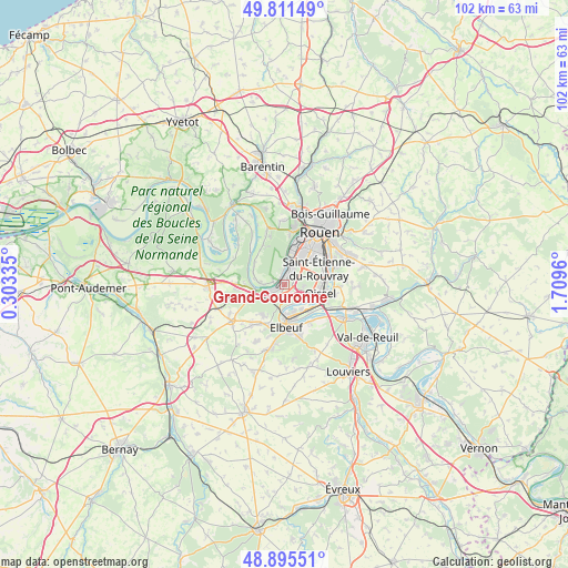
Grand-Couronne GPS coordinates[2]
49° 21' 20.268" North, 1° 0' 23.292" East
| Map corner | latitude | longitude |
|---|---|---|
| Upper-left | 49.81149°, | 0.30335° |
| Center: | 49.35563°, | 1.00647° |
| Lower-right: | 48.89551°, | 1.7096° |
| Map W x H: | 101.8×101.8 km | = 63.3×63.3mi |
| max Lat: | 51.07786° ⇑12.9% North |
| Grand-Couronne: | 49.35563° |
| min Lat: | ⇓87.1% South 41.3874° |
| min Long | Grand-Couronne | max Long |
| -5.08615° | 1.00647° | 9.52242° |
| W 31.3%⇐ | ⇒68.7% E |
Elevation
Elevation of Grand-Couronne is 17 m = 56 ft, and this is 176.7 m = 580 ft below average elevation for this country.
| Max E: |
2333 m = 7654 ft | 95% |
| Avg. | 193.7 m = 635 ft | |
| Grand-Couronne | 17 m = 56 ft | |
Min E: |
-1 m = -3 ft | 5% |
See also: France elevation on elevation.city.
Geographical zone
Grand-Couronne is located in North temperate zone (between Tropic of Cancer and the Arctic Circle). Distance of this North polar circle is 1913.3 km =1188.9 mi to North.| Distance of | km | miles | from Grand-Couronne |
|---|---|---|---|
| North Pole | 4519.2 | 2808.1 | to North |
| Arctic Circle | 1913.3 | 1188.9 | to North |
| Tropic Cancer | 2881.9 | 1790.7 | to South |
| Equator | 5487.8 | 3410 | to South |


Nearby cities:
15 places around Grand-Couronne: (largest is in red/bold)
• Cléon
5.1 km =3.2 mi,  160°
160°
• Elbeuf
7.7 km =4.8 mi,  181°
181°
• Freneuse
7.1 km =4.4 mi,  127°
127°
• La Bouille
5.3 km =3.3 mi,  263°
263°
• Le Grand-Quevilly
5.8 km =3.6 mi,  29°
29°
• Le Petit-Quevilly
7.6 km =4.7 mi, 31°
• Moulineaux
3.7 km =2.3 mi,  248°
248°
• Oissel
6.8 km =4.2 mi,  111°
111°
• Petit-Couronne
3.2 km =2 mi,  13°
13°
• Sahurs
4.6 km =2.9 mi,  274°
274°
• Saint-Aubin-lès-Elbeuf
5.8 km =3.6 mi, 177°
• Saint-Pierre-de-Manneville
6.7 km =4.2 mi,  308°
308°
• Saint-Étienne-du-Rouvray
7.5 km =4.7 mi,  70°
70°
• Tourville-la-Rivière
7.8 km =4.8 mi, 113°
• Val-de-la-Haye
2.6 km =1.6 mi,  352°
352°
Sources, notices
• [Note1] Compared only with cities in France existing in our database
• [Src1] Map data: © OpenStreetMap contributors (CC-BY-SA)
• [Src2] Other city data from geonames.org with taken over terms of usage.
• [Src3] Geographical zone / Annual Mean Temperature by Robert A. Rohde @ Wikipedia
