Oissel geodata
Oissel (Normandy) is a populated place; located in France in Europe/Paris (GMT+2) time zone. With population of 11,495 people, there are 840 cities with bigger population in this country. Compared to other cities in France, 86.7% of cities are located further ↓South; 67.9% of cities are located further →East and 99.6% of cities have higher elevation than Oissel. Note1
Administrative division(s):
- Level 1: Normandy
- Level 2: Seine-Maritime
- Level 3: Arrondissement de Rouen
- Level 4: Oissel


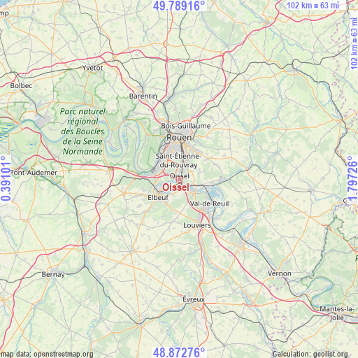
Oissel GPS coordinates[2]
49° 19' 59.124" North, 1° 5' 38.868" East
| Map corner | latitude | longitude |
|---|---|---|
| Upper-left | 49.78916°, | 0.39101° |
| Center: | 49.33309°, | 1.09413° |
| Lower-right: | 48.87276°, | 1.79726° |
| Map W x H: | 101.9×101.9 km | = 63.3×63.3mi |
| max Lat: | 51.07786° ⇑13.3% North |
| Oissel: | 49.33309° |
| min Lat: | ⇓86.7% South 41.3874° |
| min Long | Oissel | max Long |
| -5.08615° | 1.09413° | 9.52242° |
| W 32.1%⇐ | ⇒67.9% E |
Elevation
Elevation of Oissel is 4 m = 13 ft, and this is 189.7 m = 622 ft below average elevation for this country.
| Max E: |
2333 m = 7654 ft | 99.6% |
| Avg. | 193.7 m = 635 ft | |
| Oissel | 4 m = 13 ft | |
Min E: |
-1 m = -3 ft | 0.4% |
See also: France elevation on elevation.city.
Geographical zone
Oissel is located in North temperate zone (between Tropic of Cancer and the Arctic Circle). Distance of this North polar circle is 1915.8 km =1190.4 mi to North.| Distance of | km | miles | from Oissel |
|---|---|---|---|
| North Pole | 4521.7 | 2809.7 | to North |
| Arctic Circle | 1915.8 | 1190.4 | to North |
| Tropic Cancer | 2879.4 | 1789.2 | to South |
| Equator | 5485.3 | 3408.4 | to South |


Nearby cities:
15 places around Oissel: (largest is in red/bold)
• Alizay
6.2 km =3.9 mi,  101°
101°
• Belbeuf
7 km =4.3 mi,  29°
29°
• Cléon
5.2 km =3.2 mi,  243°
243°
• Criquebeuf-sur-Seine
3.1 km =1.9 mi,  172°
172°
• Freneuse
2 km =1.2 mi,  203°
203°
• Gouy
4.6 km =2.9 mi,  59°
59°
• Grand-Couronne
6.8 km =4.2 mi,  291°
291°
• Igoville
4.2 km =2.6 mi,  110°
110°
• Les Authieux-sur-le-Port-Saint-Ouen
3.1 km =1.9 mi,  73°
73°
• Saint-Aubin-Celloville
5.8 km =3.6 mi,  54°
54°
• Saint-Aubin-lès-Elbeuf
6.9 km =4.3 mi, 241°
• Saint-Étienne-du-Rouvray
5 km =3.1 mi,  8°
8°
• Sotteville-sous-le-Val
2.7 km =1.7 mi,  125°
125°
• Tourville-la-Rivière
1 km =0.6 mi, 125°
• Ymare
6.5 km =4 mi, 72°
Sources, notices
• [Note1] Compared only with cities in France existing in our database
• [Src1] Map data: © OpenStreetMap contributors (CC-BY-SA)
• [Src2] Other city data from geonames.org with taken over terms of usage.
• [Src3] Geographical zone / Annual Mean Temperature by Robert A. Rohde @ Wikipedia
