Saint-Aubin-de-Terregatte geodata
Saint-Aubin-de-Terregatte (Normandy) is a populated place; located in France in Europe/Paris (GMT+2) time zone. With population of 580 people, there are 13652 cities with bigger population in this country. Compared to other cities in France, 70.3% of cities are located further ↓South; 90.7% of cities are located further →East and 74.1% of cities have higher elevation than Saint-Aubin-de-Terregatte. Note1
Administrative division(s):
- Level 1: Normandy
- Level 2: Manche
- Level 3: Avranches
- Level 4: Saint-Aubin-de-Terregatte
Current local time in Saint-Aubin-de-Terregatte:
05:51 AM, WednesdayDifference from your time zone: hours


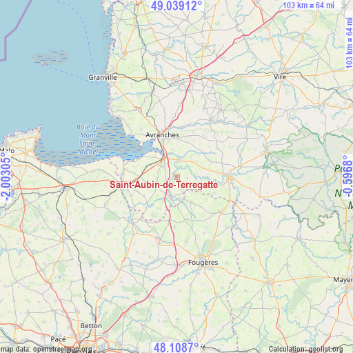
Saint-Aubin-de-Terregatte GPS coordinates[2]
48° 34' 33.78" North, 1° 17' 59.748" West
| Map corner | latitude | longitude |
|---|---|---|
| Upper-left | 49.03912°, | -2.00305° |
| Center: | 48.57605°, | -1.29993° |
| Lower-right: | 48.1087°, | -0.5968° |
| Map W x H: | 103.5×103.5 km | = 64.3×64.3mi |
| max Lat: | 51.07786° ⇑29.7% North |
| Saint-Aubin-de-Terregatte: | 48.57605° |
| min Lat: | ⇓70.3% South 41.3874° |
| min Long | Saint-Aubin-de- | max Long |
| -5.08615° | -1.29993° | 9.52242° |
| W 9.3%⇐ | ⇒90.7% E |
Elevation
Elevation of Saint-Aubin-de-Terregatte is 69 m = 226 ft, and this is 124.7 m = 409 ft below average elevation for this country.
| Max E: |
2333 m = 7654 ft | 74.1% |
| Avg. | 193.7 m = 635 ft | |
| Saint-Aubin-de-Terregatte | 69 m = 226 ft | |
Min E: |
-1 m = -3 ft | 25.9% |
See also: France elevation on elevation.city.
Geographical zone
Saint-Aubin-de-Terregatte is located in North temperate zone (between Tropic of Cancer and the Arctic Circle). Distance of this North polar circle is 2000 km =1242.7 mi to North.| Distance of | km | miles | from Saint-Aubin-de-Terregatte |
|---|---|---|---|
| North Pole | 4605.9 | 2862 | to North |
| Arctic Circle | 2000 | 1242.7 | to North |
| Tropic Cancer | 2795.2 | 1736.9 | to South |
| Equator | 5401.2 | 3356.1 | to South |


Nearby cities:
15 places around Saint-Aubin-de-Terregatte: (largest is in red/bold)
• Argouges
10.9 km =6.8 mi,  221°
221°
• Ducey
4.8 km =3 mi,  8°
8°
• Isigny-le-Buat
10.6 km =6.6 mi,  64°
64°
• Le Ferré
9.3 km =5.8 mi,  177°
177°
• Le Val-Saint-Père
11.1 km =6.9 mi,  329°
329°
• Poilley
4.7 km =2.9 mi,  350°
350°
• Saint-Brice-de-Landelles
11.9 km =7.4 mi,  113°
113°
• Saint-Georges-de-Reintembault
8.7 km =5.4 mi,  151°
151°
• Saint-James
6.3 km =3.9 mi,  197°
197°
• Saint-Laurent-de-Terregatte
3 km =1.9 mi,  99°
99°
• Saint-Loup
10.2 km =6.3 mi,  1°
1°
• Saint-Martin-de-Landelles
10 km =6.2 mi, 110°
• Saint-Martin-des-Champs
10.6 km =6.6 mi, 346°
• Saint-Quentin-sur-le-Homme
8.1 km =5 mi, 350°
• Saint-Senier-sous-Avranches
12.2 km =7.6 mi, 349°
Sources, notices
• [Note1] Compared only with cities in France existing in our database
• [Src1] Map data: © OpenStreetMap contributors (CC-BY-SA)
• [Src2] Other city data from geonames.org with taken over terms of usage.
• [Src3] Geographical zone / Annual Mean Temperature by Robert A. Rohde @ Wikipedia
