Saint-Aubin-des-Bois geodata
Saint-Aubin-des-Bois (Centre) is a populated place; located in France in Europe/Paris (GMT+2) time zone. With population of 1,029 people, there are 8622 cities with bigger population in this country. Compared to other cities in France, 67.6% of cities are located further ↓South; 64.9% of cities are located further →East and 60.3% of cities have lower elevation than Saint-Aubin-des-Bois. Note1
Administrative division(s):
- Level 1: Centre
- Level 2: Département d'Eure-et-Loir
- Level 3: Arrondissement de Chartres
- Level 4: Saint-Aubin-des-Bois


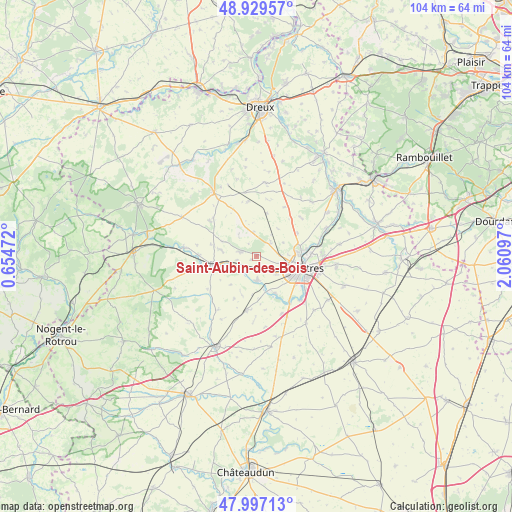
Saint-Aubin-des-Bois GPS coordinates[2]
48° 27' 55.764" North, 1° 21' 28.224" East
| Map corner | latitude | longitude |
|---|---|---|
| Upper-left | 48.92957°, | 0.65472° |
| Center: | 48.46549°, | 1.35784° |
| Lower-right: | 47.99713°, | 2.06097° |
| Map W x H: | 103.7×103.7 km | = 64.4×64.4mi |
| max Lat: | 51.07786° ⇑32.4% North |
| Saint-Aubin-des-Bois: | 48.46549° |
| min Lat: | ⇓67.6% South 41.3874° |
| min Long | Saint-Aubin-des | max Long |
| -5.08615° | 1.35784° | 9.52242° |
| W 35.1%⇐ | ⇒64.9% E |
Elevation
Elevation of Saint-Aubin-des-Bois is 171 m = 561 ft, and this is 22.7 m = 74 ft below average elevation for this country.
| Max E: |
2333 m = 7654 ft | 39.7% |
| Avg. | 193.7 m = 635 ft | |
| Saint-Aubin-des-Bois | 171 m = 561 ft | |
Min E: |
-1 m = -3 ft | 60.3% |
See also: France elevation on elevation.city.
Geographical zone
Saint-Aubin-des-Bois is located in North temperate zone (between Tropic of Cancer and the Arctic Circle). Distance of this North polar circle is 2012.3 km =1250.4 mi to North.| Distance of | km | miles | from Saint-Aubin-des-Bois |
|---|---|---|---|
| North Pole | 4618.2 | 2869.6 | to North |
| Arctic Circle | 2012.3 | 1250.4 | to North |
| Tropic Cancer | 2782.9 | 1729.2 | to South |
| Equator | 5388.9 | 3348.5 | to South |


Nearby cities:
15 places around Saint-Aubin-des-Bois: (largest is in red/bold)
• Amilly
3.6 km =2.2 mi,  133°
133°
• Bailleau-l’Évêque
3.9 km =2.4 mi,  46°
46°
• Chartres
9.9 km =6.2 mi,  102°
102°
• Clévilliers
8.9 km =5.5 mi,  13°
13°
• Courville-sur-Eure
8.8 km =5.5 mi,  257°
257°
• Fontaine-la-Guyon
3.3 km =2.1 mi,  283°
283°
• Fontenay-sur-Eure
8.7 km =5.4 mi,  152°
152°
• Lucé
8.4 km =5.2 mi,  112°
112°
• Luisant
9.4 km =5.8 mi,  115°
115°
• Lèves
9.2 km =5.7 mi,  86°
86°
• Mainvilliers
7.4 km =4.6 mi, 103°
• Ollé
9.6 km =6 mi,  207°
207°
• Saint-Arnoult-des-Bois
7.6 km =4.7 mi,  292°
292°
• Saint-Georges-sur-Eure
5.2 km =3.2 mi,  182°
182°
• Saint-Luperce
4.5 km =2.8 mi,  223°
223°
Sources, notices
• [Note1] Compared only with cities in France existing in our database
• [Src1] Map data: © OpenStreetMap contributors (CC-BY-SA)
• [Src2] Other city data from geonames.org with taken over terms of usage.
• [Src3] Geographical zone / Annual Mean Temperature by Robert A. Rohde @ Wikipedia
