Fontenay-sur-Eure geodata
Fontenay-sur-Eure (Centre) is a populated place; located in France in Europe/Paris (GMT+2) time zone. With population of 736 people, there are 11334 cities with bigger population in this country. Compared to other cities in France, 66.2% of cities are located further ↓South; 64.1% of cities are located further →East and 53.9% of cities have lower elevation than Fontenay-sur-Eure. Note1
Administrative division(s):
- Level 1: Centre
- Level 2: Département d'Eure-et-Loir
- Level 3: Arrondissement de Chartres
- Level 4: Fontenay-sur-Eure


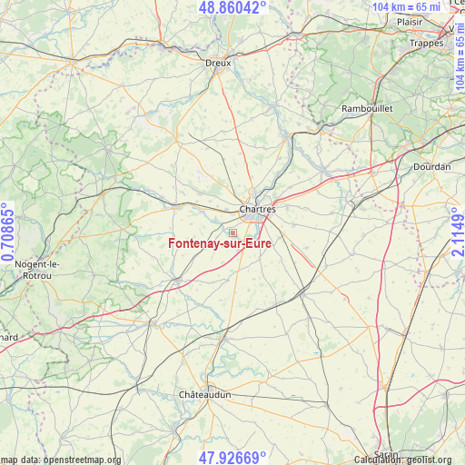
Fontenay-sur-Eure GPS coordinates[2]
48° 23' 44.52" North, 1° 24' 42.408" East
| Map corner | latitude | longitude |
|---|---|---|
| Upper-left | 48.86042°, | 0.70865° |
| Center: | 48.3957°, | 1.41178° |
| Lower-right: | 47.92669°, | 2.1149° |
| Map W x H: | 103.8×103.8 km | = 64.5×64.5mi |
| max Lat: | 51.07786° ⇑33.8% North |
| Fontenay-sur-Eure: | 48.3957° |
| min Lat: | ⇓66.2% South 41.3874° |
| min Long | Fontenay-sur-Eu | max Long |
| -5.08615° | 1.41178° | 9.52242° |
| W 35.9%⇐ | ⇒64.1% E |
Elevation
Elevation of Fontenay-sur-Eure is 146 m = 479 ft, and this is 47.7 m = 156 ft below average elevation for this country.
| Max E: |
2333 m = 7654 ft | 46.1% |
| Avg. | 193.7 m = 635 ft | |
| Fontenay-sur-Eure | 146 m = 479 ft | |
Min E: |
-1 m = -3 ft | 53.9% |
See also: France elevation on elevation.city.
Geographical zone
Fontenay-sur-Eure is located in North temperate zone (between Tropic of Cancer and the Arctic Circle). Distance of this North polar circle is 2020.1 km =1255.2 mi to North.| Distance of | km | miles | from Fontenay-sur-Eure |
|---|---|---|---|
| North Pole | 4626 | 2874.5 | to North |
| Arctic Circle | 2020.1 | 1255.2 | to North |
| Tropic Cancer | 2775.2 | 1724.4 | to South |
| Equator | 5381.1 | 3343.7 | to South |


Nearby cities:
15 places around Fontenay-sur-Eure: (largest is in red/bold)
• Amilly
5.5 km =3.4 mi,  345°
345°
• Bailleau-le-Pin
6.9 km =4.3 mi,  242°
242°
• Barjouville
5 km =3.1 mi,  71°
71°
• Chartres
8.1 km =5 mi,  45°
45°
• Dammarie
8.5 km =5.3 mi,  133°
133°
• Le Coudray
7.1 km =4.4 mi, 66°
• Lucé
6 km =3.7 mi,  39°
39°
• Luisant
5.9 km =3.7 mi, 50°
• Mainvilliers
6.9 km =4.3 mi,  28°
28°
• Mignières
4.2 km =2.6 mi,  166°
166°
• Morancez
6.1 km =3.8 mi,  84°
84°
• Ollé
8.5 km =5.3 mi,  264°
264°
• Saint-Georges-sur-Eure
4.9 km =3 mi,  301°
301°
• Saint-Luperce
8.4 km =5.2 mi, 302°
• Thivars
3.5 km =2.2 mi,  123°
123°
Sources, notices
• [Note1] Compared only with cities in France existing in our database
• [Src1] Map data: © OpenStreetMap contributors (CC-BY-SA)
• [Src2] Other city data from geonames.org with taken over terms of usage.
• [Src3] Geographical zone / Annual Mean Temperature by Robert A. Rohde @ Wikipedia
