Bailleau-l’Évêque geodata
Bailleau-l’Évêque (Centre) is a populated place; located in France in Europe/Paris (GMT+2) time zone. With population of 1,103 people, there are 8112 cities with bigger population in this country. Compared to other cities in France, 68.1% of cities are located further ↓South; 64.3% of cities are located further →East and 59.3% of cities have lower elevation than Bailleau-l’Évêque. Note1
Administrative division(s):
- Level 1: Centre
- Level 2: Département d'Eure-et-Loir
- Level 3: Arrondissement de Chartres
- Level 4: Bailleau-l'Évêque


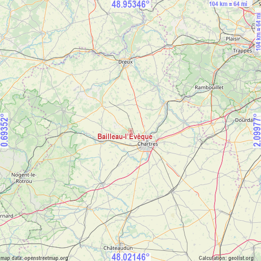
Bailleau-l’Évêque GPS coordinates[2]
48° 29' 22.56" North, 1° 23' 47.94" East
| Map corner | latitude | longitude |
|---|---|---|
| Upper-left | 48.95346°, | 0.69352° |
| Center: | 48.4896°, | 1.39665° |
| Lower-right: | 48.02146°, | 2.09977° |
| Map W x H: | 103.6×103.6 km | = 64.4×64.4mi |
| max Lat: | 51.07786° ⇑31.9% North |
| Bailleau-l’Évêque: | 48.4896° |
| min Lat: | ⇓68.1% South 41.3874° |
| min Long | Bailleau-l’É | max Long |
| -5.08615° | 1.39665° | 9.52242° |
| W 35.7%⇐ | ⇒64.3% E |
Elevation
Elevation of Bailleau-l’Évêque is 167 m = 548 ft, and this is 26.7 m = 88 ft below average elevation for this country.
| Max E: |
2333 m = 7654 ft | 40.7% |
| Avg. | 193.7 m = 635 ft | |
| Bailleau-l’Évêque | 167 m = 548 ft | |
Min E: |
-1 m = -3 ft | 59.3% |
See also: France elevation on elevation.city.
Geographical zone
Bailleau-l’Évêque is located in North temperate zone (between Tropic of Cancer and the Arctic Circle). Distance of this North polar circle is 2009.6 km =1248.7 mi to North.| Distance of | km | miles | from Bailleau-l’Évêque |
|---|---|---|---|
| North Pole | 4615.5 | 2867.9 | to North |
| Arctic Circle | 2009.6 | 1248.7 | to North |
| Tropic Cancer | 2785.6 | 1730.9 | to South |
| Equator | 5391.5 | 3350.1 | to South |


Nearby cities:
15 places around Bailleau-l’Évêque: (largest is in red/bold)
• Amilly
5.2 km =3.2 mi,  182°
182°
• Champhol
8.2 km =5.1 mi,  106°
106°
• Chartres
8.3 km =5.2 mi,  124°
124°
• Clévilliers
6.1 km =3.8 mi,  352°
352°
• Fontaine-la-Guyon
6.4 km =4 mi,  252°
252°
• Gâtelles
10 km =6.2 mi,  306°
306°
• Lucé
7.7 km =4.8 mi,  139°
139°
• Luisant
8.8 km =5.5 mi, 139°
• Lèves
6.6 km =4.1 mi, 108°
• Mainvilliers
6.2 km =3.9 mi, 135°
• Saint-Arnoult-des-Bois
9.8 km =6.1 mi,  271°
271°
• Saint-Aubin-des-Bois
3.9 km =2.4 mi,  226°
226°
• Saint-Georges-sur-Eure
8.5 km =5.3 mi,  201°
201°
• Saint-Luperce
8.5 km =5.3 mi,  224°
224°
• Saint-Prest
9.9 km =6.2 mi,  89°
89°
Sources, notices
• [Note1] Compared only with cities in France existing in our database
• [Src1] Map data: © OpenStreetMap contributors (CC-BY-SA)
• [Src2] Other city data from geonames.org with taken over terms of usage.
• [Src3] Geographical zone / Annual Mean Temperature by Robert A. Rohde @ Wikipedia
