Saint-Amé geodata
Saint-Amé (Grand Est) is a populated place; located in France in Europe/Paris (GMT+2) time zone. With population of 2,045 people, there are 4692 cities with bigger population in this country. Compared to other cities in France, 59.7% of cities are located further ↓South; 92.8% of cities are located further ←West and 88.4% of cities have lower elevation than Saint-Amé. Note1
Administrative division(s):
- Level 1: Grand Est
- Level 2: Vosges
- Level 3: Arrondissement d’Épinal
- Level 4: Saint-Amé


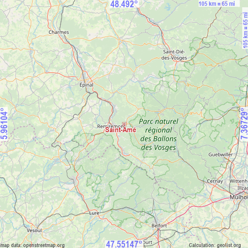
Saint-Amé GPS coordinates[2]
48° 1' 25.968" North, 6° 39' 50.976" East
| Map corner | latitude | longitude |
|---|---|---|
| Upper-left | 48.492°, | 5.96104° |
| Center: | 48.02388°, | 6.66416° |
| Lower-right: | 47.55147°, | 7.36729° |
| Map W x H: | 104.6×104.6 km | = 65×65mi |
| max Lat: | 51.07786° ⇑40.3% North |
| Saint-Amé: | 48.02388° |
| min Lat: | ⇓59.7% South 41.3874° |
| min Long | Saint-Amé | max Long |
| -5.08615° | 6.66416° | 9.52242° |
| W 92.8%⇐ | ⇒7.2% E |
Elevation
Elevation of Saint-Amé is 395 m = 1296 ft, and this is 201.3 m = 660 ft above average elevation for this country.
| Max E: |
2333 m = 7654 ft | 11.6% |
| Saint-Amé | 395 m 1296 ft | |
| Avg. | 193.7 m = 635 ft | |
Min E: |
-1 m = -3 ft | 88.4% |
See also: France elevation on elevation.city.
Geographical zone
Saint-Amé is located in North temperate zone (between Tropic of Cancer and the Arctic Circle). Distance of this North polar circle is 2061.4 km =1280.9 mi to North.| Distance of | km | miles | from Saint-Amé |
|---|---|---|---|
| North Pole | 4667.3 | 2900.1 | to North |
| Arctic Circle | 2061.4 | 1280.9 | to North |
| Tropic Cancer | 2733.8 | 1698.7 | to South |
| Equator | 5339.8 | 3318 | to South |


Nearby cities:
15 places around Saint-Amé: (largest is in red/bold)
• Basse-sur-le-Rupt
8.1 km =5 mi,  121°
121°
• Dommartin-lès-Remiremont
3.3 km =2.1 mi,  212°
212°
• La Forge
6.4 km =4 mi,  44°
44°
• Le Syndicat
1.7 km =1.1 mi, 115°
• Le Tholy
8.8 km =5.5 mi, 42°
• Remiremont
5.7 km =3.5 mi,  262°
262°
• Rochesson
9.2 km =5.7 mi,  91°
91°
• Rupt-sur-Moselle
11.2 km =7 mi,  180°
180°
• Saint-Nabord
6.8 km =4.2 mi,  297°
297°
• Saint-Étienne-lès-Remiremont
4.1 km =2.5 mi,  268°
268°
• Sapois
6.5 km =4 mi, 94°
• Thiéfosse
7.8 km =4.8 mi,  140°
140°
• Vagney
4.4 km =2.7 mi, 116°
• Vecoux
5.5 km =3.4 mi,  201°
201°
• Éloyes
9.3 km =5.8 mi,  332°
332°
Sources, notices
• [Note1] Compared only with cities in France existing in our database
• [Src1] Map data: © OpenStreetMap contributors (CC-BY-SA)
• [Src2] Other city data from geonames.org with taken over terms of usage.
• [Src3] Geographical zone / Annual Mean Temperature by Robert A. Rohde @ Wikipedia
