Basse-sur-le-Rupt geodata
Basse-sur-le-Rupt (Grand Est) is a populated place; located in France in Europe/Paris (GMT+2) time zone. With population of 844 people, there are 10142 cities with bigger population in this country. Compared to other cities in France, 59% of cities are located further ↓South; 93.4% of cities are located further ←West and 95.6% of cities have lower elevation than Basse-sur-le-Rupt. Note1
Administrative division(s):
- Level 1: Grand Est
- Level 2: Vosges
- Level 3: Arrondissement d’Épinal
- Level 4: Basse-sur-le-Rupt


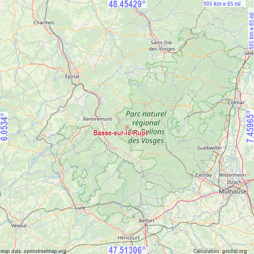
Basse-sur-le-Rupt GPS coordinates[2]
47° 59' 8.952" North, 6° 45' 23.472" East
| Map corner | latitude | longitude |
|---|---|---|
| Upper-left | 48.45429°, | 6.0534° |
| Center: | 47.98582°, | 6.75652° |
| Lower-right: | 47.51306°, | 7.45965° |
| Map W x H: | 104.7×104.7 km | = 65.1×65.1mi |
| max Lat: | 51.07786° ⇑41% North |
| Basse-sur-le-Rupt: | 47.98582° |
| min Lat: | ⇓59% South 41.3874° |
| min Long | Basse-sur-le-Ru | max Long |
| -5.08615° | 6.75652° | 9.52242° |
| W 93.4%⇐ | ⇒6.6% E |
Elevation
Elevation of Basse-sur-le-Rupt is 616 m = 2021 ft, and this is 422.3 m = 1385 ft above average elevation for this country.
| Max E: |
2333 m = 7654 ft | 4.4% |
| Basse-sur-le-Rupt | 616 m 2021 ft | |
| Avg. | 193.7 m = 635 ft | |
Min E: |
-1 m = -3 ft | 95.6% |
See also: France elevation on elevation.city.
Geographical zone
Basse-sur-le-Rupt is located in North temperate zone (between Tropic of Cancer and the Arctic Circle). Distance of this North polar circle is 2065.7 km =1283.6 mi to North.| Distance of | km | miles | from Basse-sur-le-Rupt |
|---|---|---|---|
| North Pole | 4671.5 | 2902.7 | to North |
| Arctic Circle | 2065.7 | 1283.6 | to North |
| Tropic Cancer | 2729.6 | 1696.1 | to South |
| Equator | 5335.5 | 3315.3 | to South |


Nearby cities:
15 places around Basse-sur-le-Rupt: (largest is in red/bold)
• Cornimont
6.2 km =3.9 mi,  117°
117°
• Dommartin-lès-Remiremont
8.8 km =5.5 mi,  279°
279°
• Ferdrupt
9.5 km =5.9 mi,  201°
201°
• La Bresse
8.2 km =5.1 mi,  79°
79°
• La Forge
9.1 km =5.7 mi,  344°
344°
• Le Ménil
9.2 km =5.7 mi,  168°
168°
• Le Syndicat
6.4 km =4 mi,  303°
303°
• Rochesson
4.6 km =2.9 mi,  29°
29°
• Saint-Amé
8.1 km =5 mi, 301°
• Sapois
3.7 km =2.3 mi,  354°
354°
• Saulxures-sur-Moselotte
4.2 km =2.6 mi, 165°
• Thiéfosse
2.6 km =1.6 mi,  227°
227°
• Vagney
3.7 km =2.3 mi,  308°
308°
• Vecoux
9 km =5.6 mi,  264°
264°
• Ventron
9.9 km =6.2 mi, 121°
Sources, notices
• [Note1] Compared only with cities in France existing in our database
• [Src1] Map data: © OpenStreetMap contributors (CC-BY-SA)
• [Src2] Other city data from geonames.org with taken over terms of usage.
• [Src3] Geographical zone / Annual Mean Temperature by Robert A. Rohde @ Wikipedia
