Ruillé-sur-Loir geodata
Ruillé-sur-Loir (Pays de la Loire) is a populated place; located in France in Europe/Paris (GMT+2) time zone. With population of 1,368 people, there are 6731 cities with bigger population in this country. Compared to other cities in France, 55% of cities are located further ↓South; 72.1% of cities are located further →East and 77.8% of cities have higher elevation than Ruillé-sur-Loir. Note1
Administrative division(s):
- Level 1: Pays de la Loire
- Level 2: Sarthe
- Level 3: Arrondissement de La Flèche
- Level 4: Loir en Vallée


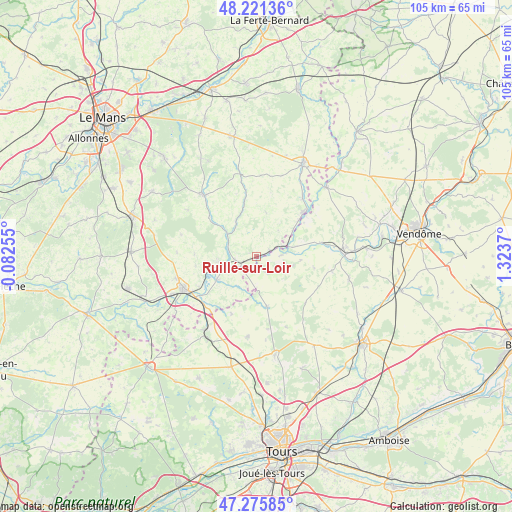
Ruillé-sur-Loir GPS coordinates[2]
47° 45' 2.7" North, 0° 37' 14.088" East
| Map corner | latitude | longitude |
|---|---|---|
| Upper-left | 48.22136°, | -0.08255° |
| Center: | 47.75075°, | 0.62058° |
| Lower-right: | 47.27585°, | 1.3237° |
| Map W x H: | 105.1×105.1 km | = 65.3×65.3mi |
| max Lat: | 51.07786° ⇑45% North |
| Ruillé-sur-Loir: | 47.75075° |
| min Lat: | ⇓55% South 41.3874° |
| min Long | Ruillé-sur-Loi | max Long |
| -5.08615° | 0.62058° | 9.52242° |
| W 27.9%⇐ | ⇒72.1% E |
Elevation
Elevation of Ruillé-sur-Loir is 60 m = 197 ft, and this is 133.7 m = 439 ft below average elevation for this country.
| Max E: |
2333 m = 7654 ft | 77.8% |
| Avg. | 193.7 m = 635 ft | |
| Ruillé-sur-Loir | 60 m = 197 ft | |
Min E: |
-1 m = -3 ft | 22.2% |
See also: France elevation on elevation.city.
Geographical zone
Ruillé-sur-Loir is located in North temperate zone (between Tropic of Cancer and the Arctic Circle). Distance of this North polar circle is 2091.8 km =1299.8 mi to North.| Distance of | km | miles | from Ruillé-sur-Loir |
|---|---|---|---|
| North Pole | 4697.7 | 2919 | to North |
| Arctic Circle | 2091.8 | 1299.8 | to North |
| Tropic Cancer | 2703.5 | 1679.9 | to South |
| Equator | 5309.4 | 3299.1 | to South |


Nearby cities:
15 places around Ruillé-sur-Loir: (largest is in red/bold)
• Bessé-sur-Braye
13.3 km =8.3 mi,  46°
46°
• Chahaignes
8.1 km =5 mi,  262°
262°
• Chemillé-sur-Dême
10.5 km =6.5 mi,  168°
168°
• Courdemanche
8.4 km =5.2 mi,  328°
328°
• Dissay-sous-Courcillon
14.6 km =9.1 mi,  229°
229°
• Flée
12.7 km =7.9 mi, 261°
• Jupilles
16.2 km =10.1 mi,  286°
286°
• La Chapelle-Huon
15 km =9.3 mi,  38°
38°
• La Chartre-sur-le-Loir
4.5 km =2.8 mi,  240°
240°
• Les Hermites
13.8 km =8.6 mi,  133°
133°
• Lhomme
4.7 km =2.9 mi, 260°
• Marçon
9.3 km =5.8 mi, 241°
• Saint-Martin-des-Bois
15.7 km =9.8 mi,  100°
100°
• Saint-Vincent-du-Lorouër
12.8 km =8 mi,  310°
310°
• Vouvray-sur-Loir
13.3 km =8.3 mi, 242°
Sources, notices
• [Note1] Compared only with cities in France existing in our database
• [Src1] Map data: © OpenStreetMap contributors (CC-BY-SA)
• [Src2] Other city data from geonames.org with taken over terms of usage.
• [Src3] Geographical zone / Annual Mean Temperature by Robert A. Rohde @ Wikipedia
