La Chartre-sur-le-Loir geodata
La Chartre-sur-le-Loir (Pays de la Loire) is a populated place; located in France in Europe/Paris (GMT+2) time zone. With population of 1,633 people, there are 5722 cities with bigger population in this country. Compared to other cities in France, 54.7% of cities are located further ↓South; 72.7% of cities are located further →East and 77% of cities have higher elevation than La Chartre-sur-le-Loir. Note1
Administrative division(s):
- Level 1: Pays de la Loire
- Level 2: Sarthe
- Level 3: Arrondissement de La Flèche
- Level 4: La Chartre-sur-le-Loir
Current local time in La Chartre-sur-le-Loir:
12:12 PM, SaturdayDifference from your time zone: hours


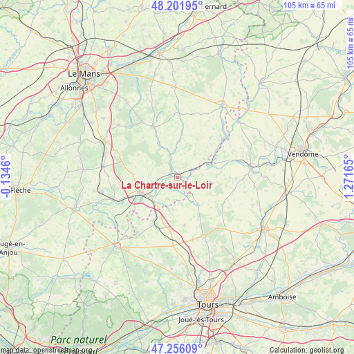
La Chartre-sur-le-Loir GPS coordinates[2]
47° 43' 52.212" North, 0° 34' 6.672" East
| Map corner | latitude | longitude |
|---|---|---|
| Upper-left | 48.20195°, | -0.1346° |
| Center: | 47.73117°, | 0.56852° |
| Lower-right: | 47.25609°, | 1.27165° |
| Map W x H: | 105.2×105.2 km | = 65.4×65.4mi |
| max Lat: | 51.07786° ⇑45.3% North |
| La Chartre-sur-le-Loir: | 47.73117° |
| min Lat: | ⇓54.7% South 41.3874° |
| min Long | La Chartre-sur- | max Long |
| -5.08615° | 0.56852° | 9.52242° |
| W 27.3%⇐ | ⇒72.7% E |
Elevation
Elevation of La Chartre-sur-le-Loir is 62 m = 203 ft, and this is 131.7 m = 432 ft below average elevation for this country.
| Max E: |
2333 m = 7654 ft | 77% |
| Avg. | 193.7 m = 635 ft | |
| La Chartre-sur-le-Loir | 62 m = 203 ft | |
Min E: |
-1 m = -3 ft | 23% |
See also: France elevation on elevation.city.
Geographical zone
La Chartre-sur-le-Loir is located in North temperate zone (between Tropic of Cancer and the Arctic Circle). Distance of this North polar circle is 2094 km =1301.2 mi to North.| Distance of | km | miles | from La Chartre-sur-le-Loir |
|---|---|---|---|
| North Pole | 4699.9 | 2920.4 | to North |
| Arctic Circle | 2094 | 1301.2 | to North |
| Tropic Cancer | 2701.3 | 1678.5 | to South |
| Equator | 5307.2 | 3297.7 | to South |


Nearby cities:
15 places around La Chartre-sur-le-Loir: (largest is in red/bold)
• Chahaignes
4.3 km =2.7 mi,  285°
285°
• Chemillé-sur-Dême
10 km =6.2 mi,  143°
143°
• Château-du-Loir
11.9 km =7.4 mi,  250°
250°
• Courdemanche
9.3 km =5.8 mi,  357°
357°
• Dissay-sous-Courcillon
10.3 km =6.4 mi,  224°
224°
• Flée
8.6 km =5.3 mi,  271°
271°
• Jupilles
13.4 km =8.3 mi,  299°
299°
• Lhomme
1.5 km =0.9 mi,  333°
333°
• Luceau
13 km =8.1 mi,  260°
260°
• Marçon
4.9 km =3 mi,  241°
241°
• Neuvy-le-Roi
14.3 km =8.9 mi,  172°
172°
• Ruillé-sur-Loir
4.5 km =2.8 mi,  60°
60°
• Saint-Christophe-sur-le-Nais
14.4 km =8.9 mi,  208°
208°
• Saint-Vincent-du-Lorouër
12 km =7.5 mi, 330°
• Vouvray-sur-Loir
8.8 km =5.5 mi, 243°
Sources, notices
• [Note1] Compared only with cities in France existing in our database
• [Src1] Map data: © OpenStreetMap contributors (CC-BY-SA)
• [Src2] Other city data from geonames.org with taken over terms of usage.
• [Src3] Geographical zone / Annual Mean Temperature by Robert A. Rohde @ Wikipedia
