La Chapelle-Huon geodata
La Chapelle-Huon (Pays de la Loire) is a populated place; located in France in Europe/Paris (GMT+2) time zone. With population of 620 people, there are 12983 cities with bigger population in this country. Compared to other cities in France, 56.7% of cities are located further ↓South; 71.1% of cities are located further →East and 64.4% of cities have higher elevation than La Chapelle-Huon. Note1
Administrative division(s):
- Level 1: Pays de la Loire
- Level 2: Sarthe
- Level 3: Arrondissement de Mamers
- Level 4: La Chapelle-Huon


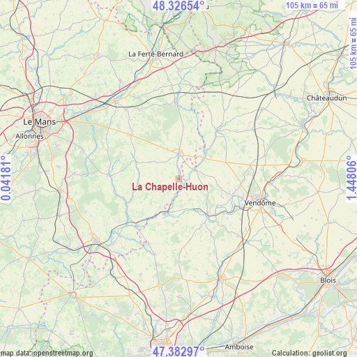
La Chapelle-Huon GPS coordinates[2]
47° 51' 24.84" North, 0° 44' 41.784" East
| Map corner | latitude | longitude |
|---|---|---|
| Upper-left | 48.32654°, | 0.04181° |
| Center: | 47.8569°, | 0.74494° |
| Lower-right: | 47.38297°, | 1.44806° |
| Map W x H: | 104.9×104.9 km | = 65.2×65.2mi |
| max Lat: | 51.07786° ⇑43.3% North |
| La Chapelle-Huon: | 47.8569° |
| min Lat: | ⇓56.7% South 41.3874° |
| min Long | La Chapelle-Huo | max Long |
| -5.08615° | 0.74494° | 9.52242° |
| W 28.9%⇐ | ⇒71.1% E |
Elevation
Elevation of La Chapelle-Huon is 91 m = 299 ft, and this is 102.7 m = 337 ft below average elevation for this country.
| Max E: |
2333 m = 7654 ft | 64.4% |
| Avg. | 193.7 m = 635 ft | |
| La Chapelle-Huon | 91 m = 299 ft | |
Min E: |
-1 m = -3 ft | 35.6% |
See also: France elevation on elevation.city.
Geographical zone
La Chapelle-Huon is located in North temperate zone (between Tropic of Cancer and the Arctic Circle). Distance of this North polar circle is 2080 km =1292.5 mi to North.| Distance of | km | miles | from La Chapelle-Huon |
|---|---|---|---|
| North Pole | 4685.9 | 2911.7 | to North |
| Arctic Circle | 2080 | 1292.5 | to North |
| Tropic Cancer | 2715.3 | 1687.2 | to South |
| Equator | 5321.2 | 3306.4 | to South |


Nearby cities:
15 places around La Chapelle-Huon: (largest is in red/bold)
• Bessé-sur-Braye
2.6 km =1.6 mi,  171°
171°
• Conflans-sur-Anille
9.9 km =6.2 mi,  359°
359°
• Cormenon
16.6 km =10.3 mi,  41°
41°
• Coudrecieux
17.4 km =10.8 mi,  330°
330°
• Courdemanche
14.4 km =8.9 mi,  251°
251°
• Lunay
13.8 km =8.6 mi,  112°
112°
• Mazangé
15.4 km =9.6 mi,  103°
103°
• Montaillé
9.4 km =5.8 mi,  340°
340°
• Montoire-sur-le-Loir
14.6 km =9.1 mi,  142°
142°
• Ruillé-sur-Loir
15 km =9.3 mi,  218°
218°
• Saint-Calais
7.3 km =4.5 mi,  0°
0°
• Saint-Martin-des-Bois
16 km =9.9 mi,  157°
157°
• Sargé-sur-Braye
11 km =6.8 mi,  47°
47°
• Savigny-sur-Braye
5.4 km =3.4 mi,  62°
62°
• Épuisay
14.7 km =9.1 mi,  70°
70°
Sources, notices
• [Note1] Compared only with cities in France existing in our database
• [Src1] Map data: © OpenStreetMap contributors (CC-BY-SA)
• [Src2] Other city data from geonames.org with taken over terms of usage.
• [Src3] Geographical zone / Annual Mean Temperature by Robert A. Rohde @ Wikipedia
