Ruffec geodata
Ruffec (Centre) is a populated place; located in France in Europe/Paris (GMT+2) time zone. With population of 554 people, there are 14131 cities with bigger population in this country. Compared to other cities in France, 59% of cities are located further ↑North; 67.1% of cities are located further →East and 67.4% of cities have higher elevation than Ruffec. Note1
Administrative division(s):
- Level 1: Centre
- Level 2: Département de l'Indre
- Level 3: Le Blanc
- Level 4: Ruffec


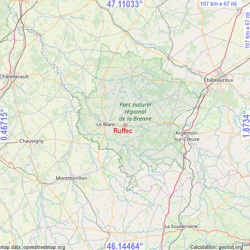
Ruffec GPS coordinates[2]
46° 37' 46.704" North, 1° 10' 13.008" East
| Map corner | latitude | longitude |
|---|---|---|
| Upper-left | 47.11033°, | 0.46715° |
| Center: | 46.62964°, | 1.17028° |
| Lower-right: | 46.14464°, | 1.8734° |
| Map W x H: | 107.4×107.4 km | = 66.7×66.7mi |
| max Lat: | 51.07786° ⇑59% North |
| Ruffec: | 46.62964° |
| min Lat: | ⇓41% South 41.3874° |
| min Long | Ruffec | max Long |
| -5.08615° | 1.17028° | 9.52242° |
| W 32.9%⇐ | ⇒67.1% E |
Elevation
Elevation of Ruffec is 84 m = 276 ft, and this is 109.7 m = 360 ft below average elevation for this country.
| Max E: |
2333 m = 7654 ft | 67.4% |
| Avg. | 193.7 m = 635 ft | |
| Ruffec | 84 m = 276 ft | |
Min E: |
-1 m = -3 ft | 32.6% |
See also: France elevation on elevation.city.
Geographical zone
Ruffec is located in North temperate zone (between Tropic of Cancer and the Arctic Circle). Distance of this North polar circle is 2216.4 km =1377.2 mi to North.| Distance of | km | miles | from Ruffec |
|---|---|---|---|
| North Pole | 4822.3 | 2996.4 | to North |
| Arctic Circle | 2216.4 | 1377.2 | to North |
| Tropic Cancer | 2578.8 | 1602.4 | to South |
| Equator | 5184.7 | 3221.6 | to South |


Nearby cities:
15 places around Ruffec: (largest is in red/bold)
• Bélâbre
8.8 km =5.5 mi,  186°
186°
• Béthines
17.5 km =10.9 mi,  238°
238°
• Ciron
5.7 km =3.5 mi,  92°
92°
• Concremiers
12.3 km =7.6 mi,  252°
252°
• La Trimouille
20.6 km =12.8 mi,  208°
208°
• Le Blanc
8.2 km =5.1 mi,  273°
273°
• Lignac
18.6 km =11.6 mi,  168°
168°
• Mérigny
18.6 km =11.6 mi, 270°
• Pouligny-Saint-Pierre
11.5 km =7.1 mi,  299°
299°
• Prissac
17 km =10.6 mi,  141°
141°
• Rivarennes
16.5 km =10.3 mi, 87°
• Rosnay
8.6 km =5.3 mi,  23°
23°
• Saint-Gaultier
18.5 km =11.5 mi, 88°
• Thenay
19.6 km =12.2 mi, 89°
• Tournon-Saint-Martin
20.1 km =12.5 mi,  305°
305°
Sources, notices
• [Note1] Compared only with cities in France existing in our database
• [Src1] Map data: © OpenStreetMap contributors (CC-BY-SA)
• [Src2] Other city data from geonames.org with taken over terms of usage.
• [Src3] Geographical zone / Annual Mean Temperature by Robert A. Rohde @ Wikipedia
