Royères geodata
Royères (Nouvelle-Aquitaine) is a populated place; located in France in Europe/Paris (GMT+2) time zone. With population of 829 people, there are 10301 cities with bigger population in this country. Compared to other cities in France, 68.4% of cities are located further ↑North; 63.9% of cities are located further →East and 81% of cities have lower elevation than Royères. Note1
Administrative division(s):
- Level 1: Nouvelle-Aquitaine
- Level 2: Haute-Vienne
- Level 3: Arrondissement de Limoges
- Level 4: Royères


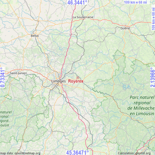
Royères GPS coordinates[2]
45° 51' 23.616" North, 1° 26' 11.508" East
| Map corner | latitude | longitude |
|---|---|---|
| Upper-left | 46.3441°, | 0.73341° |
| Center: | 45.85656°, | 1.43653° |
| Lower-right: | 45.36471°, | 2.13966° |
| Map W x H: | 108.9×108.9 km | = 67.7×67.7mi |
| max Lat: | 51.07786° ⇑68.4% North |
| Royères: | 45.85656° |
| min Lat: | ⇓31.6% South 41.3874° |
| min Long | Royères | max Long |
| -5.08615° | 1.43653° | 9.52242° |
| W 36.1%⇐ | ⇒63.9% E |
Elevation
Elevation of Royères is 300 m = 984 ft, and this is 106.3 m = 349 ft above average elevation for this country.
| Max E: |
2333 m = 7654 ft | 19% |
| Royères | 300 m 984 ft | |
| Avg. | 193.7 m = 635 ft | |
Min E: |
-1 m = -3 ft | 81% |
See also: France elevation on elevation.city.
Geographical zone
Royères is located in North temperate zone (between Tropic of Cancer and the Arctic Circle). Distance of this North polar circle is 2302.4 km =1430.6 mi to North.| Distance of | km | miles | from Royères |
|---|---|---|---|
| North Pole | 4908.3 | 3049.9 | to North |
| Arctic Circle | 2302.4 | 1430.6 | to North |
| Tropic Cancer | 2492.9 | 1549 | to South |
| Equator | 5098.8 | 3168.2 | to South |


Nearby cities:
15 places around Royères: (largest is in red/bold)
• Ambazac
11.6 km =7.2 mi,  345°
345°
• Aureil
6.6 km =4.1 mi,  211°
211°
• Boisseuil
12.6 km =7.8 mi,  220°
220°
• Champnétery
10.8 km =6.7 mi,  104°
104°
• Eyjeaux
9.5 km =5.9 mi,  201°
201°
• Feytiat
9.7 km =6 mi,  237°
237°
• La Geneytouse
8.2 km =5.1 mi,  163°
163°
• Le Palais-sur-Vienne
8.8 km =5.5 mi,  275°
275°
• Panazol
10 km =6.2 mi,  258°
258°
• Rilhac-Rancon
10.3 km =6.4 mi,  296°
296°
• Saint-Just-le-Martel
3.9 km =2.4 mi, 279°
• Saint-Laurent-les-Églises
11.4 km =7.1 mi,  24°
24°
• Saint-Léonard-de-Noblat
4.7 km =2.9 mi,  117°
117°
• Saint-Paul
11.8 km =7.3 mi,  181°
181°
• Saint-Priest-Taurion
4.4 km =2.7 mi,  319°
319°
Sources, notices
• [Note1] Compared only with cities in France existing in our database
• [Src1] Map data: © OpenStreetMap contributors (CC-BY-SA)
• [Src2] Other city data from geonames.org with taken over terms of usage.
• [Src3] Geographical zone / Annual Mean Temperature by Robert A. Rohde @ Wikipedia
