Plaine geodata
Plaine (Grand Est) is a populated place; located in France in Europe/Paris (GMT+2) time zone. With population of 846 people, there are 10125 cities with bigger population in this country. Compared to other cities in France, 66.7% of cities are located further ↓South; 95.5% of cities are located further ←West and 92.8% of cities have lower elevation than Plaine. Note1
Administrative division(s):
- Level 1: Grand Est
- Level 2: Bas-Rhin
- Level 3: Arrondissement de Molsheim
- Level 4: Plaine


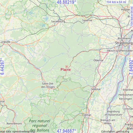
Plaine GPS coordinates[2]
48° 25' 3.612" North, 7° 8' 44.844" East
| Map corner | latitude | longitude |
|---|---|---|
| Upper-left | 48.88219°, | 6.44267° |
| Center: | 48.41767°, | 7.14579° |
| Lower-right: | 47.94887°, | 7.84892° |
| Map W x H: | 103.8×103.8 km | = 64.5×64.5mi |
| max Lat: | 51.07786° ⇑33.3% North |
| Plaine: | 48.41767° |
| min Lat: | ⇓66.7% South 41.3874° |
| min Long | Plaine | max Long |
| -5.08615° | 7.14579° | 9.52242° |
| W 95.5%⇐ | ⇒4.5% E |
Elevation
Elevation of Plaine is 500 m = 1640 ft, and this is 306.3 m = 1005 ft above average elevation for this country.
| Max E: |
2333 m = 7654 ft | 7.2% |
| Plaine | 500 m 1640 ft | |
| Avg. | 193.7 m = 635 ft | |
Min E: |
-1 m = -3 ft | 92.8% |
See also: France elevation on elevation.city.
Geographical zone
Plaine is located in North temperate zone (between Tropic of Cancer and the Arctic Circle). Distance of this North polar circle is 2017.6 km =1253.7 mi to North.| Distance of | km | miles | from Plaine |
|---|---|---|---|
| North Pole | 4623.5 | 2872.9 | to North |
| Arctic Circle | 2017.6 | 1253.7 | to North |
| Tropic Cancer | 2777.6 | 1725.9 | to South |
| Equator | 5383.5 | 3345.2 | to South |


Nearby cities:
15 places around Plaine: (largest is in red/bold)
• Barembach
9.1 km =5.7 mi,  42°
42°
• Breitenbach
12.2 km =7.6 mi,  119°
119°
• Colroy-la-Grande
11.5 km =7.1 mi,  193°
193°
• La Broque
8.1 km =5 mi, 40°
• La Petite-Raon
11.2 km =7 mi,  263°
263°
• Maisonsgoutte
11.3 km =7 mi,  129°
129°
• Moussey
9.4 km =5.8 mi,  276°
276°
• Natzwiller
8.5 km =5.3 mi,  74°
74°
• Provenchères-sur-Fave
13.2 km =8.2 mi,  202°
202°
• Rothau
6.3 km =3.9 mi,  46°
46°
• Russ
12.1 km =7.5 mi, 43°
• Saales
8.1 km =5 mi, 200°
• Schirmeck
9.1 km =5.7 mi, 36°
• Senones
12.6 km =7.8 mi, 258°
• Steige
9 km =5.6 mi, 133°
Sources, notices
• [Note1] Compared only with cities in France existing in our database
• [Src1] Map data: © OpenStreetMap contributors (CC-BY-SA)
• [Src2] Other city data from geonames.org with taken over terms of usage.
• [Src3] Geographical zone / Annual Mean Temperature by Robert A. Rohde @ Wikipedia
