Retournac geodata
Retournac (Auvergne-Rhône-Alpes) is a populated place; located in France in Europe/Paris (GMT+2) time zone. With population of 2,588 people, there are 3769 cities with bigger population in this country. Compared to other cities in France, 77.4% of cities are located further ↑North; 68.1% of cities are located further ←West and 93.5% of cities have lower elevation than Retournac. Note1
Administrative division(s):
- Level 1: Auvergne-Rhône-Alpes
- Level 2: Haute-Loire
- Level 3: Yssingeaux
- Level 4: Retournac


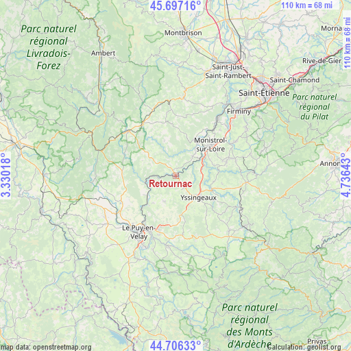
Retournac GPS coordinates[2]
45° 12' 14.04" North, 4° 1' 59.88" East
| Map corner | latitude | longitude |
|---|---|---|
| Upper-left | 45.69716°, | 3.33018° |
| Center: | 45.2039°, | 4.0333° |
| Lower-right: | 44.70633°, | 4.73643° |
| Map W x H: | 110.2×110.2 km | = 68.5×68.5mi |
| max Lat: | 51.07786° ⇑77.4% North |
| Retournac: | 45.2039° |
| min Lat: | ⇓22.6% South 41.3874° |
| min Long | Retournac | max Long |
| -5.08615° | 4.0333° | 9.52242° |
| W 68.1%⇐ | ⇒31.9% E |
Elevation
Elevation of Retournac is 523 m = 1716 ft, and this is 329.3 m = 1080 ft above average elevation for this country.
| Max E: |
2333 m = 7654 ft | 6.5% |
| Retournac | 523 m 1716 ft | |
| Avg. | 193.7 m = 635 ft | |
Min E: |
-1 m = -3 ft | 93.5% |
See also: France elevation on elevation.city.
Geographical zone
Retournac is located in North temperate zone (between Tropic of Cancer and the Arctic Circle). Distance of this North polar circle is 2375 km =1475.8 mi to North.| Distance of | km | miles | from Retournac |
|---|---|---|---|
| North Pole | 4980.9 | 3095 | to North |
| Arctic Circle | 2375 | 1475.8 | to North |
| Tropic Cancer | 2420.3 | 1503.9 | to South |
| Equator | 5026.2 | 3123.1 | to South |


Nearby cities:
15 places around Retournac: (largest is in red/bold)
• Bas-en-Basset
12.8 km =8 mi,  27°
27°
• Beaux
5.1 km =3.2 mi,  111°
111°
• Beauzac
8 km =5 mi,  39°
39°
• Chaspinhac
14.8 km =9.2 mi,  208°
208°
• Lapte
14.5 km =9 mi,  97°
97°
• Lavoûte-sur-Loire
13.8 km =8.6 mi,  226°
226°
• Les Villettes
12.2 km =7.6 mi,  73°
73°
• Malrevers
12.9 km =8 mi,  204°
204°
• Monistrol-sur-Loire
14.7 km =9.1 mi,  47°
47°
• Rosières
8.7 km =5.4 mi, 204°
• Saint-Hostien
14.6 km =9.1 mi,  175°
175°
• Saint-Maurice-de-Lignon
8.6 km =5.3 mi, 74°
• Saint-Vincent
11.8 km =7.3 mi,  235°
235°
• Vorey
9.9 km =6.2 mi,  258°
258°
• Yssingeaux
9.8 km =6.1 mi,  133°
133°
Sources, notices
• [Note1] Compared only with cities in France existing in our database
• [Src1] Map data: © OpenStreetMap contributors (CC-BY-SA)
• [Src2] Other city data from geonames.org with taken over terms of usage.
• [Src3] Geographical zone / Annual Mean Temperature by Robert A. Rohde @ Wikipedia
