Rogny-les-Sept-Écluses geodata
Rogny-les-Sept-Écluses (Bourgogne-Franche-Comté) is a populated place; located in France in Europe/Paris (GMT+2) time zone. With population of 759 people, there are 11065 cities with bigger population in this country. Compared to other cities in France, 55% of cities are located further ↓South; 56.2% of cities are located further ←West and 60.3% of cities have lower elevation than Rogny-les-Sept-Écluses. Note1
Administrative division(s):
- Level 1: Bourgogne-Franche-Comté
- Level 2: Département de l'Yonne
- Level 3: Auxerre
- Level 4: Rogny-les-Sept-Écluses
Current local time in Rogny-les-Sept-Écluses:
01:37 PM, WednesdayDifference from your time zone: hours


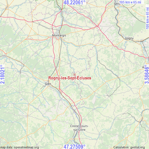
Rogny-les-Sept-Écluses GPS coordinates[2]
47° 45' 0" North, 2° 52' 59.988" East
| Map corner | latitude | longitude |
|---|---|---|
| Upper-left | 48.22061°, | 2.18021° |
| Center: | 47.75°, | 2.88333° |
| Lower-right: | 47.27509°, | 3.58646° |
| Map W x H: | 105.1×105.1 km | = 65.3×65.3mi |
| max Lat: | 51.07786° ⇑45% North |
| Rogny-les-Sept-Écluses: | 47.75° |
| min Lat: | ⇓55% South 41.3874° |
| min Long | Rogny-les-Sept- | max Long |
| -5.08615° | 2.88333° | 9.52242° |
| W 56.2%⇐ | ⇒43.8% E |
Elevation
Elevation of Rogny-les-Sept-Écluses is 171 m = 561 ft, and this is 22.7 m = 74 ft below average elevation for this country.
| Max E: |
2333 m = 7654 ft | 39.7% |
| Avg. | 193.7 m = 635 ft | |
| Rogny-les-Sept-Écluses | 171 m = 561 ft | |
Min E: |
-1 m = -3 ft | 60.3% |
See also: France elevation on elevation.city.
Geographical zone
Rogny-les-Sept-Écluses is located in North temperate zone (between Tropic of Cancer and the Arctic Circle). Distance of this North polar circle is 2091.9 km =1299.8 mi to North.| Distance of | km | miles | from Rogny-les-Sept-Écluses |
|---|---|---|---|
| North Pole | 4697.8 | 2919.1 | to North |
| Arctic Circle | 2091.9 | 1299.8 | to North |
| Tropic Cancer | 2703.4 | 1679.8 | to South |
| Equator | 5309.3 | 3299 | to South |


Nearby cities:
15 places around Rogny-les-Sept-Écluses: (largest is in red/bold)
• Bléneau
7.5 km =4.7 mi,  138°
138°
• Boismorand
12.9 km =8 mi,  287°
287°
• Briare
16.6 km =10.3 mi,  218°
218°
• Champignelles
14.7 km =9.1 mi,  76°
76°
• Châtillon-Coligny
8.6 km =5.3 mi,  340°
340°
• Dammarie-sur-Loing
3.7 km =2.3 mi,  357°
357°
• La Bussière
9.9 km =6.2 mi,  267°
267°
• Melleroy
16.9 km =10.5 mi,  17°
17°
• Montbouy
13.2 km =8.2 mi, 338°
• Nogent-sur-Vernisson
15 km =9.3 mi,  315°
315°
• Ouzouer-sur-Trézée
10.3 km =6.4 mi,  213°
213°
• Saint-Firmin-sur-Loire
17.8 km =11.1 mi, 219°
• Saint-Maurice-sur-Aveyron
11.7 km =7.3 mi, 16°
• Saint-Privé
11.5 km =7.1 mi,  130°
130°
• Sainte-Geneviève-des-Bois
9 km =5.6 mi,  326°
326°
Sources, notices
• [Note1] Compared only with cities in France existing in our database
• [Src1] Map data: © OpenStreetMap contributors (CC-BY-SA)
• [Src2] Other city data from geonames.org with taken over terms of usage.
• [Src3] Geographical zone / Annual Mean Temperature by Robert A. Rohde @ Wikipedia
