Melleroy geodata
Melleroy (Centre) is a populated place; located in France in Europe/Paris (GMT+2) time zone. With population of 542 people, there are 14349 cities with bigger population in this country. Compared to other cities in France, 57.5% of cities are located further ↓South; 57.1% of cities are located further ←West and 59.1% of cities have lower elevation than Melleroy. Note1
Administrative division(s):
- Level 1: Centre
- Level 2: Loiret
- Level 3: Arrondissement de Montargis
- Level 4: Melleroy


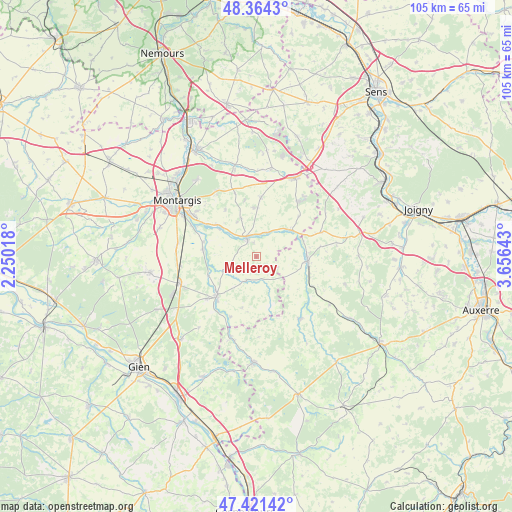
Melleroy GPS coordinates[2]
47° 53' 42.036" North, 2° 57' 11.916" East
| Map corner | latitude | longitude |
|---|---|---|
| Upper-left | 48.3643°, | 2.25018° |
| Center: | 47.89501°, | 2.95331° |
| Lower-right: | 47.42142°, | 3.65643° |
| Map W x H: | 104.8×104.8 km | = 65.1×65.1mi |
| max Lat: | 51.07786° ⇑42.5% North |
| Melleroy: | 47.89501° |
| min Lat: | ⇓57.5% South 41.3874° |
| min Long | Melleroy | max Long |
| -5.08615° | 2.95331° | 9.52242° |
| W 57.1%⇐ | ⇒42.9% E |
Elevation
Elevation of Melleroy is 166 m = 545 ft, and this is 27.7 m = 91 ft below average elevation for this country.
| Max E: |
2333 m = 7654 ft | 40.9% |
| Avg. | 193.7 m = 635 ft | |
| Melleroy | 166 m = 545 ft | |
Min E: |
-1 m = -3 ft | 59.1% |
See also: France elevation on elevation.city.
Geographical zone
Melleroy is located in North temperate zone (between Tropic of Cancer and the Arctic Circle). Distance of this North polar circle is 2075.7 km =1289.8 mi to North.| Distance of | km | miles | from Melleroy |
|---|---|---|---|
| North Pole | 4681.6 | 2909 | to North |
| Arctic Circle | 2075.7 | 1289.8 | to North |
| Tropic Cancer | 2719.5 | 1689.8 | to South |
| Equator | 5325.4 | 3309 | to South |


Nearby cities:
15 places around Melleroy: (largest is in red/bold)
• Charny
10.7 km =6.6 mi,  95°
95°
• Chuelles
12 km =7.5 mi,  4°
4°
• Château-Renard
4.5 km =2.8 mi,  340°
340°
• Châtillon-Coligny
11.4 km =7.1 mi,  224°
224°
• Dammarie-sur-Loing
13.5 km =8.4 mi,  203°
203°
• Douchy
9.2 km =5.7 mi,  54°
54°
• Gy-les-Nonains
9.6 km =6 mi,  307°
307°
• La Selle-en-Hermoy
13.7 km =8.5 mi, 341°
• Montbouy
10.7 km =6.6 mi,  249°
249°
• Montcresson
10.9 km =6.8 mi,  276°
276°
• Saint-Germain-des-Prés
10.2 km =6.3 mi, 309°
• Saint-Maurice-sur-Aveyron
5.3 km =3.3 mi, 202°
• Sainte-Geneviève-des-Bois
13.3 km =8.3 mi,  229°
229°
• Triguères
5.5 km =3.4 mi,  25°
25°
• Villefranche
14.1 km =8.8 mi,  72°
72°
Sources, notices
• [Note1] Compared only with cities in France existing in our database
• [Src1] Map data: © OpenStreetMap contributors (CC-BY-SA)
• [Src2] Other city data from geonames.org with taken over terms of usage.
• [Src3] Geographical zone / Annual Mean Temperature by Robert A. Rohde @ Wikipedia
