Rivières geodata
Rivières (Occitanie) is a populated place; located in France in Europe/Paris (GMT+2) time zone. With population of 758 people, there are 11078 cities with bigger population in this country. Compared to other cities in France, 87.9% of cities are located further ↑North; 57.6% of cities are located further →East and 53.1% of cities have lower elevation than Rivières. Note1


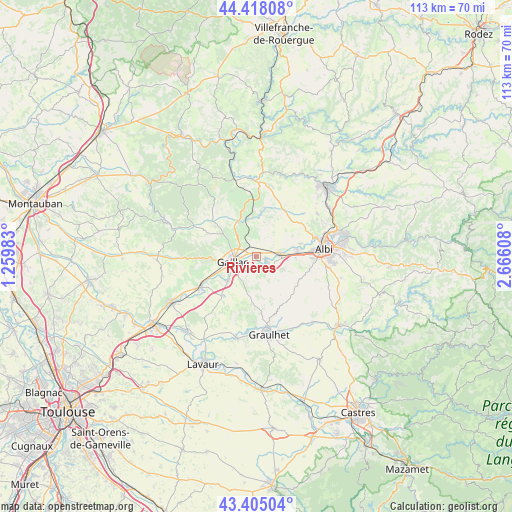
Rivières GPS coordinates[2]
43° 54' 49.392" North, 1° 57' 46.62" East
| Map corner | latitude | longitude |
|---|---|---|
| Upper-left | 44.41808°, | 1.25983° |
| Center: | 43.91372°, | 1.96295° |
| Lower-right: | 43.40504°, | 2.66608° |
| Map W x H: | 112.6×112.6 km | = 70×70mi |
| max Lat: | 51.07786° ⇑87.9% North |
| Rivières: | 43.91372° |
| min Lat: | ⇓12.1% South 41.3874° |
| min Long | Rivières | max Long |
| -5.08615° | 1.96295° | 9.52242° |
| W 42.4%⇐ | ⇒57.6% E |
Elevation
Elevation of Rivières is 143 m = 469 ft, and this is 50.7 m = 166 ft below average elevation for this country.
| Max E: |
2333 m = 7654 ft | 46.9% |
| Avg. | 193.7 m = 635 ft | |
| Rivières | 143 m = 469 ft | |
Min E: |
-1 m = -3 ft | 53.1% |
See also: France elevation on elevation.city.
Geographical zone
Rivières is located in North temperate zone (between Tropic of Cancer and the Arctic Circle). Distance of this Northern Tropic circle is 2276.8 km =1414.7 mi to South.| Distance of | km | miles | from Rivières |
|---|---|---|---|
| North Pole | 5124.3 | 3184.1 | to North |
| Arctic Circle | 2518.4 | 1564.9 | to North |
| Tropic Cancer | 2276.8 | 1414.7 | to South |
| Equator | 4882.7 | 3034 | to South |


Nearby cities:
15 places around Rivières: (largest is in red/bold)
• Brens
5.4 km =3.4 mi,  236°
236°
• Cadalen
7.3 km =4.5 mi,  168°
168°
• Cahuzac-sur-Vère
8.7 km =5.4 mi,  331°
331°
• Carlus
12 km =7.5 mi,  103°
103°
• Castelnau-de-Lévis
10.2 km =6.3 mi,  73°
73°
• Florentin
6.3 km =3.9 mi,  116°
116°
• Gaillac
5.5 km =3.4 mi,  255°
255°
• Labastide-de-Lévis
4 km =2.5 mi, 67°
• Lagrave
3 km =1.9 mi,  127°
127°
• Marssac-sur-Tarn
5.3 km =3.3 mi,  85°
85°
• Montans
8.1 km =5 mi,  230°
230°
• Rouffiac
9.1 km =5.7 mi,  111°
111°
• Senouillac
3.4 km =2.1 mi,  340°
340°
• Terssac
8.9 km =5.5 mi,  79°
79°
• Técou
7.9 km =4.9 mi,  187°
187°
Sources, notices
• [Note1] Compared only with cities in France existing in our database
• [Src1] Map data: © OpenStreetMap contributors (CC-BY-SA)
• [Src2] Other city data from geonames.org with taken over terms of usage.
• [Src3] Geographical zone / Annual Mean Temperature by Robert A. Rohde @ Wikipedia
