Rivière geodata
Rivière (Hauts-de-France) is a populated place; located in France in Europe/Paris (GMT+2) time zone. With population of 1,160 people, there are 7765 cities with bigger population in this country. Compared to other cities in France, 95% of cities are located further ↓South; 53.3% of cities are located further ←West and 65.3% of cities have higher elevation than Rivière. Note1
Administrative division(s):
- Level 1: Hauts-de-France
- Level 2: Pas-de-Calais
- Level 3: Arras
- Level 4: Rivière


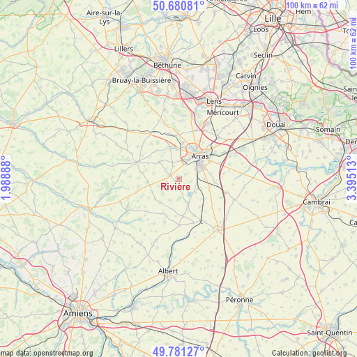
Rivière GPS coordinates[2]
50° 13' 59.376" North, 2° 41' 31.2" East
| Map corner | latitude | longitude |
|---|---|---|
| Upper-left | 50.68081°, | 1.98888° |
| Center: | 50.23316°, | 2.692° |
| Lower-right: | 49.78127°, | 3.39513° |
| Map W x H: | 100×100 km | = 62.1×62.1mi |
| max Lat: | 51.07786° ⇑5% North |
| Rivière: | 50.23316° |
| min Lat: | ⇓95% South 41.3874° |
| min Long | Rivière | max Long |
| -5.08615° | 2.692° | 9.52242° |
| W 53.3%⇐ | ⇒46.7% E |
Elevation
Elevation of Rivière is 89 m = 292 ft, and this is 104.7 m = 344 ft below average elevation for this country.
| Max E: |
2333 m = 7654 ft | 65.3% |
| Avg. | 193.7 m = 635 ft | |
| Rivière | 89 m = 292 ft | |
Min E: |
-1 m = -3 ft | 34.7% |
See also: France elevation on elevation.city.
Geographical zone
Rivière is located in North temperate zone (between Tropic of Cancer and the Arctic Circle). Distance of this North polar circle is 1815.8 km =1128.3 mi to North.| Distance of | km | miles | from Rivière |
|---|---|---|---|
| North Pole | 4421.7 | 2747.5 | to North |
| Arctic Circle | 1815.8 | 1128.3 | to North |
| Tropic Cancer | 2979.5 | 1851.4 | to South |
| Equator | 5585.4 | 3470.6 | to South |


Nearby cities:
15 places around Rivière: (largest is in red/bold)
• Achicourt
6.5 km =4 mi,  45°
45°
• Agnez-lès-Duisans
8.6 km =5.3 mi,  343°
343°
• Agny
5.6 km =3.5 mi,  59°
59°
• Anzin-Saint-Aubin
9.7 km =6 mi,  23°
23°
• Arras
9.2 km =5.7 mi,  43°
43°
• Beaumetz-lès-Loges
2.5 km =1.6 mi,  285°
285°
• Beaurains
8.2 km =5.1 mi, 63°
• Dainville
5.8 km =3.6 mi, 24°
• Duisans
8.1 km =5 mi,  357°
357°
• Ficheux
3.4 km =2.1 mi,  102°
102°
• Mercatel
7.4 km =4.6 mi,  87°
87°
• Neuville-Vitasse
9.3 km =5.8 mi,  79°
79°
• Sainte-Catherine
9.7 km =6 mi,  31°
31°
• Simencourt
4.5 km =2.8 mi,  308°
308°
• Wanquetin
7.3 km =4.5 mi, 310°
Sources, notices
• [Note1] Compared only with cities in France existing in our database
• [Src1] Map data: © OpenStreetMap contributors (CC-BY-SA)
• [Src2] Other city data from geonames.org with taken over terms of usage.
• [Src3] Geographical zone / Annual Mean Temperature by Robert A. Rohde @ Wikipedia
