Mercatel geodata
Mercatel (Hauts-de-France) is a populated place; located in France in Europe/Paris (GMT+2) time zone. With population of 585 people, there are 13555 cities with bigger population in this country. Compared to other cities in France, 95% of cities are located further ↓South; 54.9% of cities are located further ←West and 65.6% of cities have higher elevation than Mercatel. Note1
Administrative division(s):
- Level 1: Hauts-de-France
- Level 2: Pas-de-Calais
- Level 3: Arras
- Level 4: Mercatel


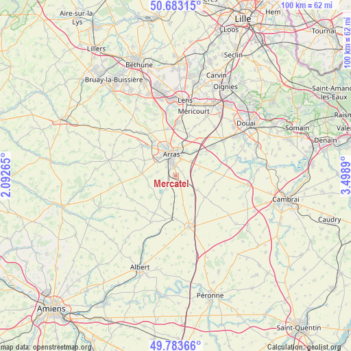
Mercatel GPS coordinates[2]
50° 14' 7.908" North, 2° 47' 44.772" East
| Map corner | latitude | longitude |
|---|---|---|
| Upper-left | 50.68315°, | 2.09265° |
| Center: | 50.23553°, | 2.79577° |
| Lower-right: | 49.78366°, | 3.4989° |
| Map W x H: | 100×100 km | = 62.1×62.1mi |
| max Lat: | 51.07786° ⇑5% North |
| Mercatel: | 50.23553° |
| min Lat: | ⇓95% South 41.3874° |
| min Long | Mercatel | max Long |
| -5.08615° | 2.79577° | 9.52242° |
| W 54.9%⇐ | ⇒45.1% E |
Elevation
Elevation of Mercatel is 88 m = 289 ft, and this is 105.7 m = 347 ft below average elevation for this country.
| Max E: |
2333 m = 7654 ft | 65.6% |
| Avg. | 193.7 m = 635 ft | |
| Mercatel | 88 m = 289 ft | |
Min E: |
-1 m = -3 ft | 34.4% |
See also: France elevation on elevation.city.
Geographical zone
Mercatel is located in North temperate zone (between Tropic of Cancer and the Arctic Circle). Distance of this North polar circle is 1815.5 km =1128.1 mi to North.| Distance of | km | miles | from Mercatel |
|---|---|---|---|
| North Pole | 4421.4 | 2747.3 | to North |
| Arctic Circle | 1815.5 | 1128.1 | to North |
| Tropic Cancer | 2979.7 | 1851.5 | to South |
| Equator | 5585.7 | 3470.8 | to South |


Nearby cities:
15 places around Mercatel: (largest is in red/bold)
• Achicourt
5.1 km =3.2 mi,  327°
327°
• Agny
3.7 km =2.3 mi,  315°
315°
• Arras
6.5 km =4 mi,  351°
351°
• Athies
7.9 km =4.9 mi,  22°
22°
• Beaurains
3.4 km =2.1 mi,  358°
358°
• Croisilles
7.2 km =4.5 mi,  123°
123°
• Dainville
7.1 km =4.4 mi, 315°
• Feuchy
7.4 km =4.6 mi,  27°
27°
• Ficheux
4.2 km =2.6 mi,  256°
256°
• Neuville-Vitasse
2.2 km =1.4 mi,  51°
51°
• Rivière
7.4 km =4.6 mi,  267°
267°
• Saint-Laurent-Blangy
6.6 km =4.1 mi,  6°
6°
• Saint-Nicolas
7.7 km =4.8 mi, 351°
• Tilloy-lès-Mofflaines
4.6 km =2.9 mi, 16°
• Wancourt
5.4 km =3.4 mi,  75°
75°
Sources, notices
• [Note1] Compared only with cities in France existing in our database
• [Src1] Map data: © OpenStreetMap contributors (CC-BY-SA)
• [Src2] Other city data from geonames.org with taken over terms of usage.
• [Src3] Geographical zone / Annual Mean Temperature by Robert A. Rohde @ Wikipedia
