Revigny-sur-Ornain geodata
Revigny-sur-Ornain (Grand Est) is a populated place; located in France in Europe/Paris (GMT+2) time zone. With population of 3,720 people, there are 2640 cities with bigger population in this country. Compared to other cities in France, 76.2% of cities are located further ↓South; 77.5% of cities are located further ←West and 53.3% of cities have lower elevation than Revigny-sur-Ornain. Note1
Administrative division(s):
- Level 1: Grand Est
- Level 2: Meuse
- Level 3: Arrondissement de Bar-le-Duc
- Level 4: Revigny-sur-Ornain


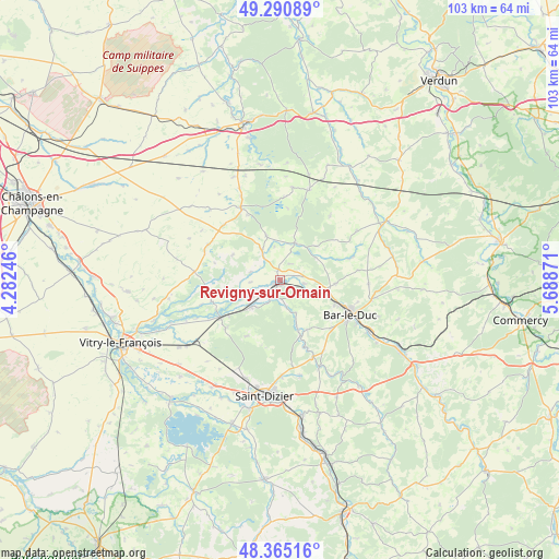
Revigny-sur-Ornain GPS coordinates[2]
48° 49' 48.576" North, 4° 59' 8.088" East
| Map corner | latitude | longitude |
|---|---|---|
| Upper-left | 49.29089°, | 4.28246° |
| Center: | 48.83016°, | 4.98558° |
| Lower-right: | 48.36516°, | 5.68871° |
| Map W x H: | 102.9×102.9 km | = 63.9×63.9mi |
| max Lat: | 51.07786° ⇑23.8% North |
| Revigny-sur-Ornain: | 48.83016° |
| min Lat: | ⇓76.2% South 41.3874° |
| min Long | Revigny-sur-Orn | max Long |
| -5.08615° | 4.98558° | 9.52242° |
| W 77.5%⇐ | ⇒22.5% E |
Elevation
Elevation of Revigny-sur-Ornain is 144 m = 472 ft, and this is 49.7 m = 163 ft below average elevation for this country.
| Max E: |
2333 m = 7654 ft | 46.7% |
| Avg. | 193.7 m = 635 ft | |
| Revigny-sur-Ornain | 144 m = 472 ft | |
Min E: |
-1 m = -3 ft | 53.3% |
See also: France elevation on elevation.city.
Geographical zone
Revigny-sur-Ornain is located in North temperate zone (between Tropic of Cancer and the Arctic Circle). Distance of this North polar circle is 1971.8 km =1225.2 mi to North.| Distance of | km | miles | from Revigny-sur-Ornain |
|---|---|---|---|
| North Pole | 4577.7 | 2844.5 | to North |
| Arctic Circle | 1971.8 | 1225.2 | to North |
| Tropic Cancer | 2823.5 | 1754.4 | to South |
| Equator | 5429.4 | 3373.7 | to South |


Nearby cities:
15 places around Revigny-sur-Ornain: (largest is in red/bold)
• Bar-le-Duc
14.4 km =8.9 mi,  116°
116°
• Behonne
15 km =9.3 mi,  105°
105°
• Beurey-sur-Saulx
8.6 km =5.3 mi,  159°
159°
• Brillon-en-Barrois
15.4 km =9.6 mi,  148°
148°
• Cheminon
11.9 km =7.4 mi,  209°
209°
• Combles-en-Barrois
13 km =8.1 mi,  132°
132°
• Contrisson
3.7 km =2.3 mi,  216°
216°
• Fains-Véel
12 km =7.5 mi, 115°
• Givry-en-Argonne
15.1 km =9.4 mi,  331°
331°
• Lisle-en-Rigault
13.4 km =8.3 mi, 160°
• Maurupt-le-Montois
13.3 km =8.3 mi,  228°
228°
• Pargny-sur-Saulx
12.8 km =8 mi,  237°
237°
• Robert-Espagne
10.1 km =6.3 mi, 161°
• Sermaize-les-Bains
7.4 km =4.6 mi, 227°
• Trémont-sur-Saulx
10.6 km =6.6 mi, 148°
Sources, notices
• [Note1] Compared only with cities in France existing in our database
• [Src1] Map data: © OpenStreetMap contributors (CC-BY-SA)
• [Src2] Other city data from geonames.org with taken over terms of usage.
• [Src3] Geographical zone / Annual Mean Temperature by Robert A. Rohde @ Wikipedia
