Givry-en-Argonne geodata
Givry-en-Argonne (Grand Est) is a populated place; located in France in Europe/Paris (GMT+2) time zone. With population of 509 people, there are 15057 cities with bigger population in this country. Compared to other cities in France, 78.6% of cities are located further ↓South; 76.3% of cities are located further ←West and 61.3% of cities have lower elevation than Givry-en-Argonne. Note1
Administrative division(s):
- Level 1: Grand Est
- Level 2: Marne
- Level 3: Arrondissement de Châlons-en-Champagne
- Level 4: Givry-en-Argonne


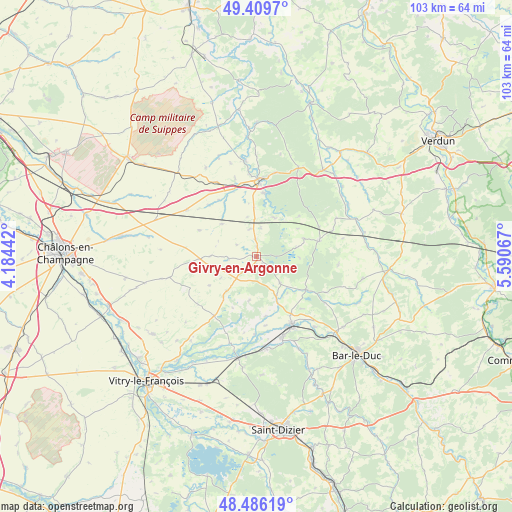
Givry-en-Argonne GPS coordinates[2]
48° 57' 0.288" North, 4° 53' 15.18" East
| Map corner | latitude | longitude |
|---|---|---|
| Upper-left | 49.4097°, | 4.18442° |
| Center: | 48.95008°, | 4.88755° |
| Lower-right: | 48.48619°, | 5.59067° |
| Map W x H: | 102.7×102.7 km | = 63.8×63.8mi |
| max Lat: | 51.07786° ⇑21.4% North |
| Givry-en-Argonne: | 48.95008° |
| min Lat: | ⇓78.6% South 41.3874° |
| min Long | Givry-en-Argonn | max Long |
| -5.08615° | 4.88755° | 9.52242° |
| W 76.3%⇐ | ⇒23.7% E |
Elevation
Elevation of Givry-en-Argonne is 176 m = 577 ft, and this is 17.7 m = 58 ft below average elevation for this country.
| Max E: |
2333 m = 7654 ft | 38.7% |
| Avg. | 193.7 m = 635 ft | |
| Givry-en-Argonne | 176 m = 577 ft | |
Min E: |
-1 m = -3 ft | 61.3% |
See also: France elevation on elevation.city.
Geographical zone
Givry-en-Argonne is located in North temperate zone (between Tropic of Cancer and the Arctic Circle). Distance of this North polar circle is 1958.4 km =1216.9 mi to North.| Distance of | km | miles | from Givry-en-Argonne |
|---|---|---|---|
| North Pole | 4564.3 | 2836.1 | to North |
| Arctic Circle | 1958.4 | 1216.9 | to North |
| Tropic Cancer | 2836.8 | 1762.7 | to South |
| Equator | 5442.7 | 3381.9 | to South |


Nearby cities:
15 places around Givry-en-Argonne: (largest is in red/bold)
• Beurey-sur-Saulx
23.7 km =14.7 mi,  154°
154°
• Cheminon
23.7 km =14.7 mi,  176°
176°
• Clermont-en-Argonne
22 km =13.7 mi,  37°
37°
• Contrisson
17.1 km =10.6 mi,  163°
163°
• Fains-Véel
25.8 km =16 mi,  135°
135°
• Les Islettes
19.6 km =12.2 mi,  25°
25°
• Maurupt-le-Montois
22.4 km =13.9 mi,  186°
186°
• Pargny-sur-Saulx
20.5 km =12.7 mi, 190°
• Revigny-sur-Ornain
15.1 km =9.4 mi, 151°
• Robert-Espagne
25.1 km =15.6 mi, 155°
• Saint-Amand-sur-Fion
25.7 km =16 mi,  233°
233°
• Sainte-Menehould
15.6 km =9.7 mi,  2°
2°
• Sermaize-les-Bains
18.4 km =11.4 mi,  174°
174°
• Seuil-d'Argonne
13.2 km =8.2 mi,  75°
75°
• Trémont-sur-Saulx
25.7 km =16 mi, 150°
Sources, notices
• [Note1] Compared only with cities in France existing in our database
• [Src1] Map data: © OpenStreetMap contributors (CC-BY-SA)
• [Src2] Other city data from geonames.org with taken over terms of usage.
• [Src3] Geographical zone / Annual Mean Temperature by Robert A. Rohde @ Wikipedia
