Reignac geodata
Reignac (Nouvelle-Aquitaine) is a populated place; located in France in Europe/Paris (GMT+2) time zone. With population of 603 people, there are 13268 cities with bigger population in this country. Compared to other cities in France, 75% of cities are located further ↑North; 79.4% of cities are located further →East and 56.5% of cities have higher elevation than Reignac. Note1
Administrative division(s):
- Level 1: Nouvelle-Aquitaine
- Level 2: Charente
- Level 3: Arrondissement de Cognac
- Level 4: Reignac


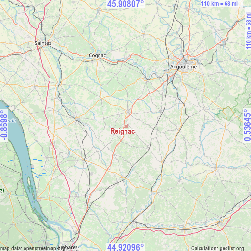
Reignac GPS coordinates[2]
45° 25' 0.012" North, 0° 10' 0.012" West
| Map corner | latitude | longitude |
|---|---|---|
| Upper-left | 45.90807°, | -0.8698° |
| Center: | 45.41667°, | -0.16667° |
| Lower-right: | 44.92096°, | 0.53645° |
| Map W x H: | 109.8×109.8 km | = 68.2×68.2mi |
| max Lat: | 51.07786° ⇑75% North |
| Reignac: | 45.41667° |
| min Lat: | ⇓25% South 41.3874° |
| min Long | Reignac | max Long |
| -5.08615° | -0.16667° | 9.52242° |
| W 20.6%⇐ | ⇒79.4% E |
Elevation
Elevation of Reignac is 112 m = 367 ft, and this is 81.7 m = 268 ft below average elevation for this country.
| Max E: |
2333 m = 7654 ft | 56.5% |
| Avg. | 193.7 m = 635 ft | |
| Reignac | 112 m = 367 ft | |
Min E: |
-1 m = -3 ft | 43.5% |
See also: France elevation on elevation.city.
Geographical zone
Reignac is located in North temperate zone (between Tropic of Cancer and the Arctic Circle). Distance of this North polar circle is 2351.3 km =1461 mi to North.| Distance of | km | miles | from Reignac |
|---|---|---|---|
| North Pole | 4957.2 | 3080.3 | to North |
| Arctic Circle | 2351.3 | 1461 | to North |
| Tropic Cancer | 2443.9 | 1518.6 | to South |
| Equator | 5049.9 | 3137.9 | to South |


Nearby cities:
15 places around Reignac: (largest is in red/bold)
• Archiac
15.2 km =9.4 mi,  316°
316°
• Baignes-Sainte-Radegonde
6.4 km =4 mi,  234°
234°
• Barbezieux-Saint-Hilaire
6.3 km =3.9 mi,  10°
10°
• Barret
7.9 km =4.9 mi,  340°
340°
• Brossac
13 km =8.1 mi,  135°
135°
• Champagnac
16.9 km =10.5 mi,  272°
272°
• Chevanceaux
14 km =8.7 mi,  201°
201°
• Condéon
3.2 km =2 mi,  125°
125°
• Criteuil-la-Magdeleine
13.5 km =8.4 mi, 343°
• Guimps
8.6 km =5.3 mi,  310°
310°
• Jurignac
16.6 km =10.3 mi,  38°
38°
• Lignières-Sonneville
16.7 km =10.4 mi,  355°
355°
• Montchaude
4.5 km =2.8 mi, 324°
• Saint-Maigrin
9.1 km =5.7 mi, 270°
• Touvérac
4.5 km =2.8 mi,  215°
215°
Sources, notices
• [Note1] Compared only with cities in France existing in our database
• [Src1] Map data: © OpenStreetMap contributors (CC-BY-SA)
• [Src2] Other city data from geonames.org with taken over terms of usage.
• [Src3] Geographical zone / Annual Mean Temperature by Robert A. Rohde @ Wikipedia
