Querrien geodata
Querrien (Brittany) is a populated place; located in France in Europe/Paris (GMT+2) time zone. With population of 1,689 people, there are 5548 cities with bigger population in this country. Compared to other cities in France, 58.7% of cities are located further ↓South; 98.4% of cities are located further →East and 57.1% of cities have lower elevation than Querrien. Note1
Administrative division(s):
- Level 1: Brittany
- Level 2: Département du Finistère
- Level 3: Arrondissement de Quimper
- Level 4: Querrien


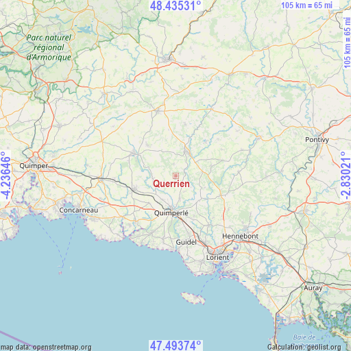
Querrien GPS coordinates[2]
47° 58' 0.012" North, 3° 31' 59.988" West
| Map corner | latitude | longitude |
|---|---|---|
| Upper-left | 48.43531°, | -4.23646° |
| Center: | 47.96667°, | -3.53333° |
| Lower-right: | 47.49374°, | -2.83021° |
| Map W x H: | 104.7×104.7 km | = 65.1×65.1mi |
| max Lat: | 51.07786° ⇑41.3% North |
| Querrien: | 47.96667° |
| min Lat: | ⇓58.7% South 41.3874° |
| min Long | Querrien | max Long |
| -5.08615° | -3.53333° | 9.52242° |
| W 1.6%⇐ | ⇒98.4% E |
Elevation
Elevation of Querrien is 158 m = 518 ft, and this is 35.7 m = 117 ft below average elevation for this country.
| Max E: |
2333 m = 7654 ft | 42.9% |
| Avg. | 193.7 m = 635 ft | |
| Querrien | 158 m = 518 ft | |
Min E: |
-1 m = -3 ft | 57.1% |
See also: France elevation on elevation.city.
Geographical zone
Querrien is located in North temperate zone (between Tropic of Cancer and the Arctic Circle). Distance of this North polar circle is 2067.8 km =1284.9 mi to North.| Distance of | km | miles | from Querrien |
|---|---|---|---|
| North Pole | 4673.7 | 2904.1 | to North |
| Arctic Circle | 2067.8 | 1284.9 | to North |
| Tropic Cancer | 2727.5 | 1694.8 | to South |
| Equator | 5333.4 | 3314 | to South |


Nearby cities:
15 places around Querrien: (largest is in red/bold)
• Arzano
10 km =6.2 mi,  136°
136°
• Bannalec
12.8 km =8 mi,  252°
252°
• Baye
13.3 km =8.3 mi,  203°
203°
• Berné
10.8 km =6.7 mi,  73°
73°
• Guiscriff
12.3 km =7.6 mi,  318°
318°
• Lanvénégen
3.5 km =2.2 mi,  350°
350°
• Le Faouët
8 km =5 mi,  23°
23°
• Le Saint
13.8 km =8.6 mi, 351°
• Le Trévoux
11.3 km =7 mi,  225°
225°
• Locunolé
5.3 km =3.3 mi,  129°
129°
• Mellac
7.7 km =4.8 mi, 204°
• Meslan
8.1 km =5 mi, 67°
• Quimperlé
11.2 km =7 mi,  186°
186°
• Saint-Thurien
7.7 km =4.8 mi,  256°
256°
• Tréméven
7.4 km =4.6 mi,  180°
180°
Sources, notices
• [Note1] Compared only with cities in France existing in our database
• [Src1] Map data: © OpenStreetMap contributors (CC-BY-SA)
• [Src2] Other city data from geonames.org with taken over terms of usage.
• [Src3] Geographical zone / Annual Mean Temperature by Robert A. Rohde @ Wikipedia
