Meslan geodata
Meslan (Brittany) is a populated place; located in France in Europe/Paris (GMT+2) time zone. With population of 1,278 people, there are 7134 cities with bigger population in this country. Compared to other cities in France, 59.1% of cities are located further ↓South; 98.2% of cities are located further →East and 57.6% of cities have higher elevation than Meslan. Note1
Administrative division(s):
- Level 1: Brittany
- Level 2: Morbihan
- Level 3: Arrondissement de Pontivy
- Level 4: Meslan


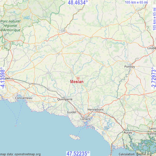
Meslan GPS coordinates[2]
47° 59' 42.072" North, 3° 25' 58.26" West
| Map corner | latitude | longitude |
|---|---|---|
| Upper-left | 48.4634°, | -4.13598° |
| Center: | 47.99502°, | -3.43285° |
| Lower-right: | 47.52235°, | -2.72973° |
| Map W x H: | 104.6×104.6 km | = 65×65mi |
| max Lat: | 51.07786° ⇑40.9% North |
| Meslan: | 47.99502° |
| min Lat: | ⇓59.1% South 41.3874° |
| min Long | Meslan | max Long |
| -5.08615° | -3.43285° | 9.52242° |
| W 1.8%⇐ | ⇒98.2% E |
Elevation
Elevation of Meslan is 109 m = 358 ft, and this is 84.7 m = 278 ft below average elevation for this country.
| Max E: |
2333 m = 7654 ft | 57.6% |
| Avg. | 193.7 m = 635 ft | |
| Meslan | 109 m = 358 ft | |
Min E: |
-1 m = -3 ft | 42.4% |
See also: France elevation on elevation.city.
Geographical zone
Meslan is located in North temperate zone (between Tropic of Cancer and the Arctic Circle). Distance of this North polar circle is 2064.6 km =1282.9 mi to North.| Distance of | km | miles | from Meslan |
|---|---|---|---|
| North Pole | 4670.5 | 2902.1 | to North |
| Arctic Circle | 2064.6 | 1282.9 | to North |
| Tropic Cancer | 2730.6 | 1696.7 | to South |
| Equator | 5336.5 | 3315.9 | to South |


Nearby cities:
15 places around Meslan: (largest is in red/bold)
• Arzano
10.4 km =6.5 mi,  183°
183°
• Berné
2.9 km =1.8 mi,  90°
90°
• Inguiniel
11.5 km =7.1 mi,  100°
100°
• Langonnet
13 km =8.1 mi,  339°
339°
• Lanvénégen
8.1 km =5 mi,  272°
272°
• Le Croisty
9.3 km =5.8 mi,  33°
33°
• Le Faouët
6 km =3.7 mi,  314°
314°
• Le Saint
14.2 km =8.8 mi,  317°
317°
• Lignol
12.9 km =8 mi,  68°
68°
• Locunolé
7.3 km =4.5 mi,  207°
207°
• Mellac
14.8 km =9.2 mi,  226°
226°
• Plouay
11.6 km =7.2 mi,  140°
140°
• Priziac
8.1 km =5 mi,  8°
8°
• Querrien
8.1 km =5 mi,  247°
247°
• Tréméven
12.9 km =8 mi,  215°
215°
Sources, notices
• [Note1] Compared only with cities in France existing in our database
• [Src1] Map data: © OpenStreetMap contributors (CC-BY-SA)
• [Src2] Other city data from geonames.org with taken over terms of usage.
• [Src3] Geographical zone / Annual Mean Temperature by Robert A. Rohde @ Wikipedia
