Lanvénégen geodata
Lanvénégen (Brittany) is a populated place; located in France in Europe/Paris (GMT+2) time zone. With population of 1,184 people, there are 7626 cities with bigger population in this country. Compared to other cities in France, 59.2% of cities are located further ↓South; 98.4% of cities are located further →East and 55.9% of cities have higher elevation than Lanvénégen. Note1
Administrative division(s):
- Level 1: Brittany
- Level 2: Morbihan
- Level 3: Arrondissement de Pontivy
- Level 4: Lanvénégen


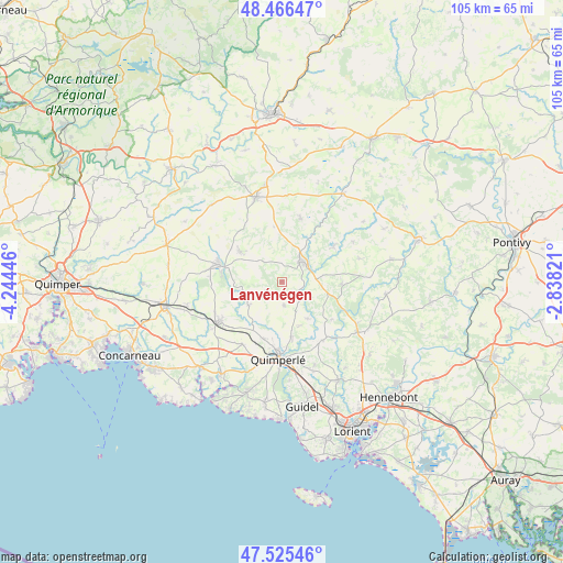
Lanvénégen GPS coordinates[2]
47° 59' 53.196" North, 3° 32' 28.824" West
| Map corner | latitude | longitude |
|---|---|---|
| Upper-left | 48.46647°, | -4.24446° |
| Center: | 47.99811°, | -3.54134° |
| Lower-right: | 47.52546°, | -2.83821° |
| Map W x H: | 104.6×104.6 km | = 65×65mi |
| max Lat: | 51.07786° ⇑40.8% North |
| Lanvénégen: | 47.99811° |
| min Lat: | ⇓59.2% South 41.3874° |
| min Long | Lanvénégen | max Long |
| -5.08615° | -3.54134° | 9.52242° |
| W 1.6%⇐ | ⇒98.4% E |
Elevation
Elevation of Lanvénégen is 114 m = 374 ft, and this is 79.7 m = 261 ft below average elevation for this country.
| Max E: |
2333 m = 7654 ft | 55.9% |
| Avg. | 193.7 m = 635 ft | |
| Lanvénégen | 114 m = 374 ft | |
Min E: |
-1 m = -3 ft | 44.1% |
See also: France elevation on elevation.city.
Geographical zone
Lanvénégen is located in North temperate zone (between Tropic of Cancer and the Arctic Circle). Distance of this North polar circle is 2064.3 km =1282.7 mi to North.| Distance of | km | miles | from Lanvénégen |
|---|---|---|---|
| North Pole | 4670.2 | 2901.9 | to North |
| Arctic Circle | 2064.3 | 1282.7 | to North |
| Tropic Cancer | 2731 | 1697 | to South |
| Equator | 5336.9 | 3316.2 | to South |


Nearby cities:
15 places around Lanvénégen: (largest is in red/bold)
• Arzano
13.1 km =8.1 mi,  145°
145°
• Berné
11 km =6.8 mi,  91°
91°
• Guiscriff
9.5 km =5.9 mi,  306°
306°
• Langonnet
12.4 km =7.7 mi,  16°
16°
• Le Faouët
5.4 km =3.4 mi,  44°
44°
• Le Saint
10.3 km =6.4 mi,  351°
351°
• Le Trévoux
13.7 km =8.5 mi,  212°
212°
• Locunolé
8.3 km =5.2 mi, 145°
• Mellac
10.9 km =6.8 mi,  194°
194°
• Meslan
8.1 km =5 mi, 92°
• Priziac
12 km =7.5 mi,  50°
50°
• Querrien
3.5 km =2.2 mi,  170°
170°
• Saint-Thurien
8.7 km =5.4 mi,  232°
232°
• Scaër
12.4 km =7.7 mi,  288°
288°
• Tréméven
10.9 km =6.8 mi,  176°
176°
Sources, notices
• [Note1] Compared only with cities in France existing in our database
• [Src1] Map data: © OpenStreetMap contributors (CC-BY-SA)
• [Src2] Other city data from geonames.org with taken over terms of usage.
• [Src3] Geographical zone / Annual Mean Temperature by Robert A. Rohde @ Wikipedia
