Quelneuc geodata
Quelneuc (Brittany) is a populated place; located in France in Europe/Paris (GMT+2) time zone. With population of 537 people, there are 14448 cities with bigger population in this country. Compared to other cities in France, 56.2% of cities are located further ↓South; 95.1% of cities are located further →East and 83.8% of cities have higher elevation than Quelneuc. Note1
Administrative division(s):
- Level 1: Brittany
- Level 2: Morbihan
- Level 3: Arrondissement de Vannes
- Level 4: Carentoir


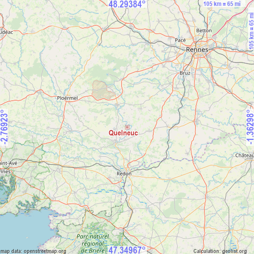
Quelneuc GPS coordinates[2]
47° 49' 26.04" North, 2° 3' 57.96" West
| Map corner | latitude | longitude |
|---|---|---|
| Upper-left | 48.29384°, | -2.76923° |
| Center: | 47.8239°, | -2.0661° |
| Lower-right: | 47.34967°, | -1.36298° |
| Map W x H: | 105×105 km | = 65.2×65.2mi |
| max Lat: | 51.07786° ⇑43.8% North |
| Quelneuc: | 47.8239° |
| min Lat: | ⇓56.2% South 41.3874° |
| min Long | Quelneuc | max Long |
| -5.08615° | -2.0661° | 9.52242° |
| W 4.9%⇐ | ⇒95.1% E |
Elevation
Elevation of Quelneuc is 45 m = 148 ft, and this is 148.7 m = 488 ft below average elevation for this country.
| Max E: |
2333 m = 7654 ft | 83.8% |
| Avg. | 193.7 m = 635 ft | |
| Quelneuc | 45 m = 148 ft | |
Min E: |
-1 m = -3 ft | 16.2% |
See also: France elevation on elevation.city.
Geographical zone
Quelneuc is located in North temperate zone (between Tropic of Cancer and the Arctic Circle). Distance of this North polar circle is 2083.7 km =1294.8 mi to North.| Distance of | km | miles | from Quelneuc |
|---|---|---|---|
| North Pole | 4689.5 | 2913.9 | to North |
| Arctic Circle | 2083.7 | 1294.8 | to North |
| Tropic Cancer | 2711.6 | 1684.9 | to South |
| Equator | 5317.5 | 3304.1 | to South |


Nearby cities:
15 places around Quelneuc: (largest is in red/bold)
• Bruc-sur-Aff
3.6 km =2.2 mi,  107°
107°
• Carentoir
5.1 km =3.2 mi,  260°
260°
• Comblessac
6 km =3.7 mi,  347°
347°
• Cournon
9.2 km =5.7 mi,  199°
199°
• Glénac
11.9 km =7.4 mi, 204°
• Guer
10.1 km =6.3 mi,  335°
335°
• La Chapelle-Gaceline
5.4 km =3.4 mi,  214°
214°
• La Gacilly
8.1 km =5 mi,  217°
217°
• Lieuron
9.7 km =6 mi,  71°
71°
• Maure-de-Bretagne
9.5 km =5.9 mi,  36°
36°
• Mernel
10.9 km =6.8 mi, 41°
• Pipriac
9.1 km =5.7 mi,  100°
100°
• Saint-Just
10.2 km =6.3 mi,  129°
129°
• Sixt-sur-Aff
5.4 km =3.4 mi,  190°
190°
• Tréal
11.9 km =7.4 mi,  277°
277°
Sources, notices
• [Note1] Compared only with cities in France existing in our database
• [Src1] Map data: © OpenStreetMap contributors (CC-BY-SA)
• [Src2] Other city data from geonames.org with taken over terms of usage.
• [Src3] Geographical zone / Annual Mean Temperature by Robert A. Rohde @ Wikipedia
