Comblessac geodata
Comblessac (Brittany) is a populated place; located in France in Europe/Paris (GMT+2) time zone. With population of 538 people, there are 14429 cities with bigger population in this country. Compared to other cities in France, 57.1% of cities are located further ↓South; 95.2% of cities are located further →East and 79.4% of cities have higher elevation than Comblessac. Note1
Administrative division(s):
- Level 1: Brittany
- Level 2: Département d'Ille-et-Vilaine
- Level 3: Arrondissement de Redon
- Level 4: Comblessac


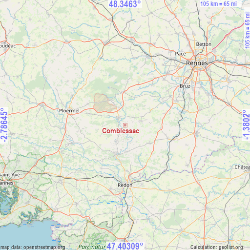
Comblessac GPS coordinates[2]
47° 52' 36.624" North, 2° 4' 59.988" West
| Map corner | latitude | longitude |
|---|---|---|
| Upper-left | 48.3463°, | -2.78645° |
| Center: | 47.87684°, | -2.08333° |
| Lower-right: | 47.40309°, | -1.3802° |
| Map W x H: | 104.9×104.9 km | = 65.2×65.2mi |
| max Lat: | 51.07786° ⇑42.9% North |
| Comblessac: | 47.87684° |
| min Lat: | ⇓57.1% South 41.3874° |
| min Long | Comblessac | max Long |
| -5.08615° | -2.08333° | 9.52242° |
| W 4.8%⇐ | ⇒95.2% E |
Elevation
Elevation of Comblessac is 56 m = 184 ft, and this is 137.7 m = 452 ft below average elevation for this country.
| Max E: |
2333 m = 7654 ft | 79.4% |
| Avg. | 193.7 m = 635 ft | |
| Comblessac | 56 m = 184 ft | |
Min E: |
-1 m = -3 ft | 20.6% |
See also: France elevation on elevation.city.
Geographical zone
Comblessac is located in North temperate zone (between Tropic of Cancer and the Arctic Circle). Distance of this North polar circle is 2077.8 km =1291.1 mi to North.| Distance of | km | miles | from Comblessac |
|---|---|---|---|
| North Pole | 4683.7 | 2910.3 | to North |
| Arctic Circle | 2077.8 | 1291.1 | to North |
| Tropic Cancer | 2717.5 | 1688.6 | to South |
| Equator | 5323.4 | 3307.8 | to South |


Nearby cities:
15 places around Comblessac: (largest is in red/bold)
• Bruc-sur-Aff
8.4 km =5.2 mi,  145°
145°
• Carentoir
7.7 km =4.8 mi,  209°
209°
• Guer
4.4 km =2.7 mi,  317°
317°
• La Chapelle-Bouexic
12.1 km =7.5 mi,  61°
61°
• La Chapelle-Gaceline
10.5 km =6.5 mi,  189°
189°
• Lieuron
10.8 km =6.7 mi,  104°
104°
• Maure-de-Bretagne
7.1 km =4.4 mi,  75°
75°
• Maxent
12.4 km =7.7 mi,  17°
17°
• Mernel
8.8 km =5.5 mi, 75°
• Monteneuf
9.4 km =5.8 mi,  267°
267°
• Porcaro
9.4 km =5.8 mi,  293°
293°
• Quelneuc
6 km =3.7 mi,  167°
167°
• Saint-Malo-de-Beignon
10.3 km =6.4 mi,  332°
332°
• Sixt-sur-Aff
11.2 km =7 mi,  178°
178°
• Tréal
11.4 km =7.1 mi,  247°
247°
Sources, notices
• [Note1] Compared only with cities in France existing in our database
• [Src1] Map data: © OpenStreetMap contributors (CC-BY-SA)
• [Src2] Other city data from geonames.org with taken over terms of usage.
• [Src3] Geographical zone / Annual Mean Temperature by Robert A. Rohde @ Wikipedia
