Carentoir geodata
Carentoir (Brittany) is a populated place; located in France in Europe/Paris (GMT+2) time zone. With population of 2,752 people, there are 3558 cities with bigger population in this country. Compared to other cities in France, 56% of cities are located further ↓South; 95.3% of cities are located further →East and 82.6% of cities have higher elevation than Carentoir. Note1
Administrative division(s):
- Level 1: Brittany
- Level 2: Morbihan
- Level 3: Arrondissement de Vannes
- Level 4: Carentoir


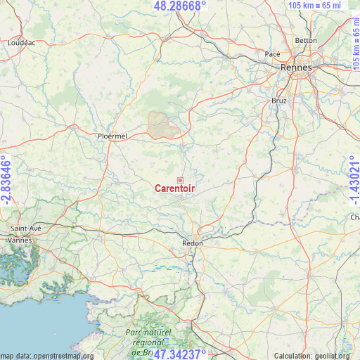
Carentoir GPS coordinates[2]
47° 49' 0.012" North, 2° 7' 59.988" West
| Map corner | latitude | longitude |
|---|---|---|
| Upper-left | 48.28668°, | -2.83646° |
| Center: | 47.81667°, | -2.13333° |
| Lower-right: | 47.34237°, | -1.43021° |
| Map W x H: | 105×105 km | = 65.2×65.2mi |
| max Lat: | 51.07786° ⇑44% North |
| Carentoir: | 47.81667° |
| min Lat: | ⇓56% South 41.3874° |
| min Long | Carentoir | max Long |
| -5.08615° | -2.13333° | 9.52242° |
| W 4.7%⇐ | ⇒95.3% E |
Elevation
Elevation of Carentoir is 48 m = 157 ft, and this is 145.7 m = 478 ft below average elevation for this country.
| Max E: |
2333 m = 7654 ft | 82.6% |
| Avg. | 193.7 m = 635 ft | |
| Carentoir | 48 m = 157 ft | |
Min E: |
-1 m = -3 ft | 17.4% |
See also: France elevation on elevation.city.
Geographical zone
Carentoir is located in North temperate zone (between Tropic of Cancer and the Arctic Circle). Distance of this North polar circle is 2084.5 km =1295.2 mi to North.| Distance of | km | miles | from Carentoir |
|---|---|---|---|
| North Pole | 4690.3 | 2914.4 | to North |
| Arctic Circle | 2084.5 | 1295.2 | to North |
| Tropic Cancer | 2710.8 | 1684.4 | to South |
| Equator | 5316.7 | 3303.6 | to South |


Nearby cities:
15 places around Carentoir: (largest is in red/bold)
• Bruc-sur-Aff
8.5 km =5.3 mi,  91°
91°
• Comblessac
7.7 km =4.8 mi,  29°
29°
• Cournon
8.1 km =5 mi,  166°
166°
• Glénac
10 km =6.2 mi,  180°
180°
• Guer
10 km =6.2 mi,  4°
4°
• La Chapelle-Gaceline
4.2 km =2.6 mi,  151°
151°
• La Gacilly
5.7 km =3.5 mi, 179°
• Les Fougerêts
10.3 km =6.4 mi,  215°
215°
• Monteneuf
8.5 km =5.3 mi,  317°
317°
• Porcaro
11.5 km =7.1 mi,  334°
334°
• Quelneuc
5.1 km =3.2 mi,  80°
80°
• Ruffiac
11.1 km =6.9 mi,  271°
271°
• Saint-Martin-sur-Oust
11.9 km =7.4 mi,  228°
228°
• Sixt-sur-Aff
6.1 km =3.8 mi,  137°
137°
• Tréal
7.2 km =4.5 mi,  289°
289°
Sources, notices
• [Note1] Compared only with cities in France existing in our database
• [Src1] Map data: © OpenStreetMap contributors (CC-BY-SA)
• [Src2] Other city data from geonames.org with taken over terms of usage.
• [Src3] Geographical zone / Annual Mean Temperature by Robert A. Rohde @ Wikipedia
