Saint-Just geodata
Saint-Just (Brittany) is a populated place; located in France in Europe/Paris (GMT+2) time zone. With population of 1,020 people, there are 8683 cities with bigger population in this country. Compared to other cities in France, 55.3% of cities are located further ↓South; 94.7% of cities are located further →East and 71.9% of cities have higher elevation than Saint-Just. Note1
Administrative division(s):
- Level 1: Brittany
- Level 2: Département d'Ille-et-Vilaine
- Level 3: Arrondissement de Redon
- Level 4: Saint-Just


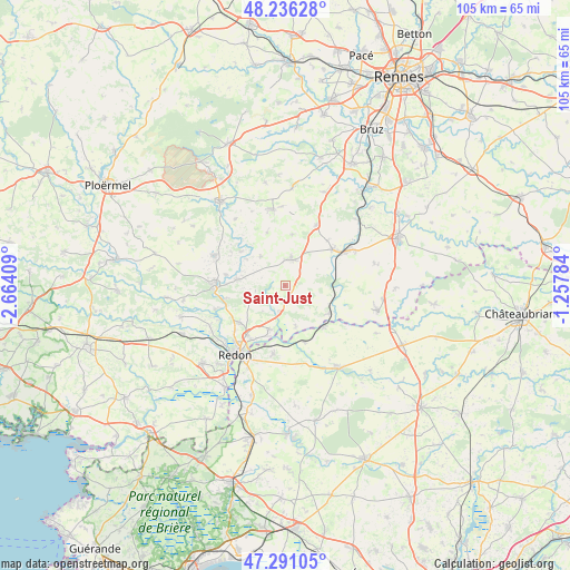
Saint-Just GPS coordinates[2]
47° 45' 56.916" North, 1° 57' 39.456" West
| Map corner | latitude | longitude |
|---|---|---|
| Upper-left | 48.23628°, | -2.66409° |
| Center: | 47.76581°, | -1.96096° |
| Lower-right: | 47.29105°, | -1.25784° |
| Map W x H: | 105.1×105.1 km | = 65.3×65.3mi |
| max Lat: | 51.07786° ⇑44.7% North |
| Saint-Just: | 47.76581° |
| min Lat: | ⇓55.3% South 41.3874° |
| min Long | Saint-Just | max Long |
| -5.08615° | -1.96096° | 9.52242° |
| W 5.3%⇐ | ⇒94.7% E |
Elevation
Elevation of Saint-Just is 74 m = 243 ft, and this is 119.7 m = 393 ft below average elevation for this country.
| Max E: |
2333 m = 7654 ft | 71.9% |
| Avg. | 193.7 m = 635 ft | |
| Saint-Just | 74 m = 243 ft | |
Min E: |
-1 m = -3 ft | 28.1% |
See also: France elevation on elevation.city.
Geographical zone
Saint-Just is located in North temperate zone (between Tropic of Cancer and the Arctic Circle). Distance of this North polar circle is 2090.1 km =1298.7 mi to North.| Distance of | km | miles | from Saint-Just |
|---|---|---|---|
| North Pole | 4696 | 2918 | to North |
| Arctic Circle | 2090.1 | 1298.7 | to North |
| Tropic Cancer | 2705.1 | 1680.9 | to South |
| Equator | 5311.1 | 3300.2 | to South |


Nearby cities:
15 places around Saint-Just: (largest is in red/bold)
• Avessac
12.7 km =7.9 mi,  189°
189°
• Bains-sur-Oust
10.7 km =6.6 mi,  229°
229°
• Bruc-sur-Aff
7 km =4.3 mi,  320°
320°
• Cournon
11.2 km =7 mi,  258°
258°
• Guipry
11.1 km =6.9 mi,  52°
52°
• La Chapelle-Gaceline
11.1 km =6.9 mi,  280°
280°
• Langon
9.7 km =6 mi,  121°
121°
• Lieuron
9.6 km =6 mi,  8°
8°
• Lohéac
12.6 km =7.8 mi,  27°
27°
• Pipriac
5 km =3.1 mi, 12°
• Quelneuc
10.2 km =6.3 mi,  309°
309°
• Renac
5.2 km =3.2 mi, 192°
• Sainte-Anne-sur-Vilaine
10.9 km =6.8 mi,  111°
111°
• Sainte-Marie
8.5 km =5.3 mi,  201°
201°
• Sixt-sur-Aff
8.9 km =5.5 mi, 277°
Sources, notices
• [Note1] Compared only with cities in France existing in our database
• [Src1] Map data: © OpenStreetMap contributors (CC-BY-SA)
• [Src2] Other city data from geonames.org with taken over terms of usage.
• [Src3] Geographical zone / Annual Mean Temperature by Robert A. Rohde @ Wikipedia
