Puygouzon geodata
Puygouzon (Occitanie) is a populated place; located in France in Europe/Paris (GMT+2) time zone. With population of 2,910 people, there are 3343 cities with bigger population in this country. Compared to other cities in France, 88% of cities are located further ↑North; 54.9% of cities are located further →East and 79.4% of cities have lower elevation than Puygouzon. Note1


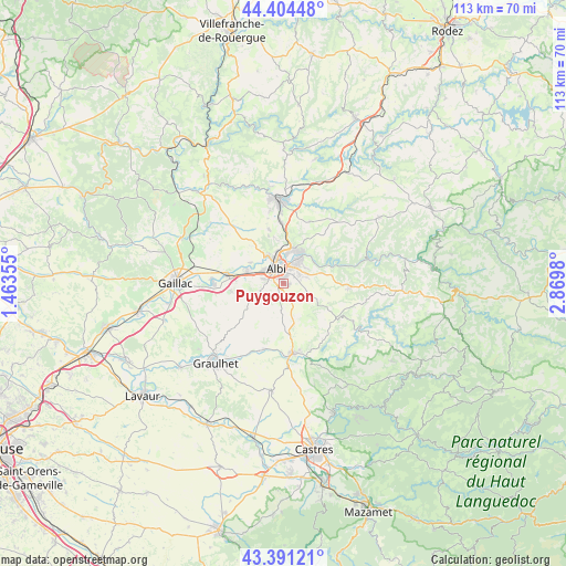
Puygouzon GPS coordinates[2]
43° 54' 0" North, 2° 10' 0.012" East
| Map corner | latitude | longitude |
|---|---|---|
| Upper-left | 44.40448°, | 1.46355° |
| Center: | 43.9°, | 2.16667° |
| Lower-right: | 43.39121°, | 2.8698° |
| Map W x H: | 112.7×112.7 km | = 70×70mi |
| max Lat: | 51.07786° ⇑88% North |
| Puygouzon: | 43.9° |
| min Lat: | ⇓12% South 41.3874° |
| min Long | Puygouzon | max Long |
| -5.08615° | 2.16667° | 9.52242° |
| W 45.1%⇐ | ⇒54.9% E |
Elevation
Elevation of Puygouzon is 284 m = 932 ft, and this is 90.3 m = 296 ft above average elevation for this country.
| Max E: |
2333 m = 7654 ft | 20.6% |
| Puygouzon | 284 m 932 ft | |
| Avg. | 193.7 m = 635 ft | |
Min E: |
-1 m = -3 ft | 79.4% |
See also: France elevation on elevation.city.
Geographical zone
Puygouzon is located in North temperate zone (between Tropic of Cancer and the Arctic Circle). Distance of this Northern Tropic circle is 2275.3 km =1413.8 mi to South.| Distance of | km | miles | from Puygouzon |
|---|---|---|---|
| North Pole | 5125.8 | 3185 | to North |
| Arctic Circle | 2520 | 1565.9 | to North |
| Tropic Cancer | 2275.3 | 1413.8 | to South |
| Equator | 4881.2 | 3033 | to South |


Nearby cities:
15 places around Puygouzon: (largest is in red/bold)
• Albi
3.6 km =2.2 mi,  335°
335°
• Arthès
7.3 km =4.5 mi,  29°
29°
• Cagnac-les-Mines
9.6 km =6 mi,  348°
348°
• Carlus
4.8 km =3 mi,  253°
253°
• Castelnau-de-Lévis
7.9 km =4.9 mi,  304°
304°
• Cunac
5.3 km =3.3 mi,  51°
51°
• Dénat
6.7 km =4.2 mi,  152°
152°
• Florentin
10.8 km =6.7 mi,  262°
262°
• Fréjairolles
5.6 km =3.5 mi,  112°
112°
• Le Sequestre
4.1 km =2.5 mi,  287°
287°
• Lombers
11.2 km =7 mi,  186°
186°
• Rouffiac
8.1 km =5 mi, 256°
• Saint-Juéry
6.9 km =4.3 mi,  35°
35°
• Saliès
3.2 km =2 mi, 253°
• Terssac
8.2 km =5.1 mi, 292°
Sources, notices
• [Note1] Compared only with cities in France existing in our database
• [Src1] Map data: © OpenStreetMap contributors (CC-BY-SA)
• [Src2] Other city data from geonames.org with taken over terms of usage.
• [Src3] Geographical zone / Annual Mean Temperature by Robert A. Rohde @ Wikipedia
