Albi geodata
Albi (Occitanie) is a seat of a second-order administrative division; located in France in Europe/Paris (GMT+2) time zone. With population of 52,409 people, there are 115 cities with bigger population in this country. Compared to other cities in France, 87.7% of cities are located further ↑North; 55.2% of cities are located further →East and 61.5% of cities have lower elevation than Albi. Note1


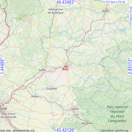
Albi GPS coordinates[2]
43° 55' 47.28" North, 2° 8' 52.8" East
| Map corner | latitude | longitude |
|---|---|---|
| Upper-left | 44.43403°, | 1.44488° |
| Center: | 43.9298°, | 2.148° |
| Lower-right: | 43.42126°, | 2.85113° |
| Map W x H: | 112.6×112.6 km | = 70×70mi |
| max Lat: | 51.07786° ⇑87.7% North |
| Albi: | 43.9298° |
| min Lat: | ⇓12.3% South 41.3874° |
| min Long | Albi | max Long |
| -5.08615° | 2.148° | 9.52242° |
| W 44.8%⇐ | ⇒55.2% E |
Elevation
Elevation of Albi is 177 m = 581 ft, and this is 16.7 m = 55 ft below average elevation for this country.
| Max E: |
2333 m = 7654 ft | 38.5% |
| Avg. | 193.7 m = 635 ft | |
| Albi | 177 m = 581 ft | |
Min E: |
-1 m = -3 ft | 61.5% |
See also: Albi elevation on elevation.city.
Geographical zone
Albi is located in North temperate zone (between Tropic of Cancer and the Arctic Circle). Distance of this Northern Tropic circle is 2278.6 km =1415.9 mi to South.| Distance of | km | miles | from Albi |
|---|---|---|---|
| North Pole | 5122.5 | 3183 | to North |
| Arctic Circle | 2516.6 | 1563.7 | to North |
| Tropic Cancer | 2278.6 | 1415.9 | to South |
| Equator | 4884.5 | 3035.1 | to South |


Nearby cities:
15 places around Albi: (largest is in red/bold)
• Arthès
5.9 km =3.7 mi,  58°
58°
• Cagnac-les-Mines
6.1 km =3.8 mi,  355°
355°
• Carlus
5.6 km =3.5 mi,  213°
213°
• Castelnau-de-Lévis
5.2 km =3.2 mi,  282°
282°
• Cunac
5.7 km =3.5 mi,  89°
89°
• Florentin
10.3 km =6.4 mi,  243°
243°
• Fréjairolles
8.6 km =5.3 mi,  129°
129°
• Le Garric
8.9 km =5.5 mi,  8°
8°
• Le Sequestre
3.2 km =2 mi,  228°
228°
• Marssac-sur-Tarn
9.6 km =6 mi,  261°
261°
• Puygouzon
3.6 km =2.2 mi,  155°
155°
• Rouffiac
8.2 km =5.1 mi, 230°
• Saint-Juéry
5.9 km =3.7 mi,  67°
67°
• Saliès
4.5 km =2.8 mi,  200°
200°
• Terssac
6.1 km =3.8 mi,  267°
267°
Sources, notices
• [Note1] Compared only with cities in France existing in our database
• [Src1] Map data: © OpenStreetMap contributors (CC-BY-SA)
• [Src2] Other city data from geonames.org with taken over terms of usage.
• [Src3] Geographical zone / Annual Mean Temperature by Robert A. Rohde @ Wikipedia
