Cagnac-les-Mines geodata
Cagnac-les-Mines (Occitanie) is a populated place; located in France in Europe/Paris (GMT+2) time zone. With population of 2,195 people, there are 4376 cities with bigger population in this country. Compared to other cities in France, 87.2% of cities are located further ↑North; 55.2% of cities are located further →East and 82.2% of cities have lower elevation than Cagnac-les-Mines. Note1
Administrative division(s):
- Level 1: Occitanie
- Level 2: Tarn
- Level 3: Albi
- Level 4: Cagnac-les-Mines


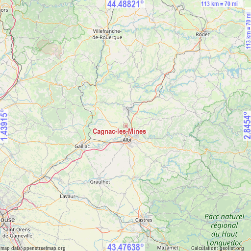
Cagnac-les-Mines GPS coordinates[2]
43° 59' 4.02" North, 2° 8' 32.172" East
| Map corner | latitude | longitude |
|---|---|---|
| Upper-left | 44.48821°, | 1.43915° |
| Center: | 43.98445°, | 2.14227° |
| Lower-right: | 43.47638°, | 2.8454° |
| Map W x H: | 112.5×112.5 km | = 69.9×69.9mi |
| max Lat: | 51.07786° ⇑87.2% North |
| Cagnac-les-Mines: | 43.98445° |
| min Lat: | ⇓12.8% South 41.3874° |
| min Long | Cagnac-les-Mine | max Long |
| -5.08615° | 2.14227° | 9.52242° |
| W 44.8%⇐ | ⇒55.2% E |
Elevation
Elevation of Cagnac-les-Mines is 312 m = 1024 ft, and this is 118.3 m = 388 ft above average elevation for this country.
| Max E: |
2333 m = 7654 ft | 17.8% |
| Cagnac-les-Mines | 312 m 1024 ft | |
| Avg. | 193.7 m = 635 ft | |
Min E: |
-1 m = -3 ft | 82.2% |
See also: France elevation on elevation.city.
Geographical zone
Cagnac-les-Mines is located in North temperate zone (between Tropic of Cancer and the Arctic Circle). Distance of this Northern Tropic circle is 2284.7 km =1419.6 mi to South.| Distance of | km | miles | from Cagnac-les-Mines |
|---|---|---|---|
| North Pole | 5116.4 | 3179.2 | to North |
| Arctic Circle | 2510.6 | 1560 | to North |
| Tropic Cancer | 2284.7 | 1419.6 | to South |
| Equator | 4890.6 | 3038.9 | to South |


Nearby cities:
15 places around Cagnac-les-Mines: (largest is in red/bold)
• Albi
6.1 km =3.8 mi,  175°
175°
• Arthès
6.3 km =3.9 mi,  118°
118°
• Blaye-les-Mines
5.2 km =3.2 mi,  350°
350°
• Carmaux
7.5 km =4.7 mi,  9°
9°
• Castelnau-de-Lévis
6.8 km =4.2 mi,  222°
222°
• Cunac
8.6 km =5.3 mi,  134°
134°
• Le Garric
3.3 km =2.1 mi,  32°
32°
• Le Sequestre
8.4 km =5.2 mi,  193°
193°
• Monestiés
9.7 km =6 mi,  339°
339°
• Puygouzon
9.6 km =6 mi,  168°
168°
• Rosières
7.4 km =4.6 mi, 25°
• Saint-Benoît-de-Carmaux
7.4 km =4.6 mi, 351°
• Saint-Juéry
7.1 km =4.4 mi, 122°
• Terssac
8.4 km =5.2 mi, 221°
• Valderiès
7.8 km =4.8 mi,  67°
67°
Sources, notices
• [Note1] Compared only with cities in France existing in our database
• [Src1] Map data: © OpenStreetMap contributors (CC-BY-SA)
• [Src2] Other city data from geonames.org with taken over terms of usage.
• [Src3] Geographical zone / Annual Mean Temperature by Robert A. Rohde @ Wikipedia
