Arthès geodata
Arthès (Occitanie) is a populated place; located in France in Europe/Paris (GMT+2) time zone. With population of 2,301 people, there are 4196 cities with bigger population in this country. Compared to other cities in France, 87.5% of cities are located further ↑North; 54.3% of cities are located further →East and 68.1% of cities have lower elevation than Arthès. Note1


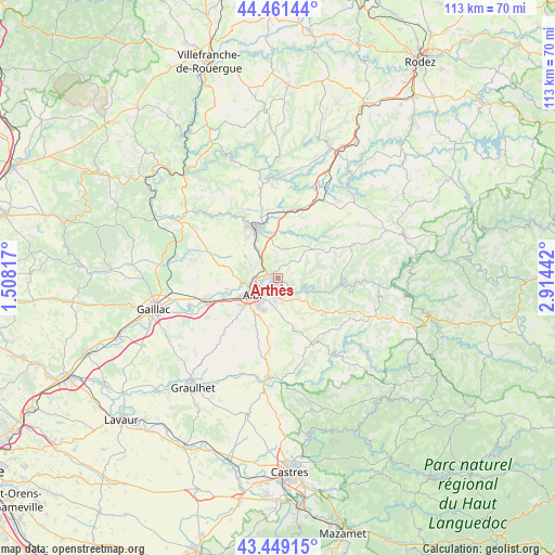
Arthès GPS coordinates[2]
43° 57' 26.82" North, 2° 12' 40.68" East
| Map corner | latitude | longitude |
|---|---|---|
| Upper-left | 44.46144°, | 1.50817° |
| Center: | 43.95745°, | 2.2113° |
| Lower-right: | 43.44915°, | 2.91442° |
| Map W x H: | 112.6×112.6 km | = 70×70mi |
| max Lat: | 51.07786° ⇑87.5% North |
| Arthès: | 43.95745° |
| min Lat: | ⇓12.5% South 41.3874° |
| min Long | Arthès | max Long |
| -5.08615° | 2.2113° | 9.52242° |
| W 45.7%⇐ | ⇒54.3% E |
Elevation
Elevation of Arthès is 210 m = 689 ft, and this is 16.3 m = 53 ft above average elevation for this country.
| Max E: |
2333 m = 7654 ft | 31.9% |
| Arthès | 210 m 689 ft | |
| Avg. | 193.7 m = 635 ft | |
Min E: |
-1 m = -3 ft | 68.1% |
See also: France elevation on elevation.city.
Geographical zone
Arthès is located in North temperate zone (between Tropic of Cancer and the Arctic Circle). Distance of this Northern Tropic circle is 2281.7 km =1417.8 mi to South.| Distance of | km | miles | from Arthès |
|---|---|---|---|
| North Pole | 5119.5 | 3181.1 | to North |
| Arctic Circle | 2513.6 | 1561.9 | to North |
| Tropic Cancer | 2281.7 | 1417.8 | to South |
| Equator | 4887.6 | 3037 | to South |


Nearby cities:
15 places around Arthès: (largest is in red/bold)
• Albi
5.9 km =3.7 mi,  238°
238°
• Blaye-les-Mines
10.3 km =6.4 mi,  321°
321°
• Cagnac-les-Mines
6.3 km =3.9 mi,  298°
298°
• Carlus
11.3 km =7 mi,  226°
226°
• Carmaux
11.2 km =7 mi,  337°
337°
• Castelnau-de-Lévis
10.3 km =6.4 mi,  258°
258°
• Cunac
3.1 km =1.9 mi,  168°
168°
• Fréjairolles
8.7 km =5.4 mi, 169°
• Le Garric
6.9 km =4.3 mi,  326°
326°
• Le Sequestre
9.1 km =5.7 mi, 235°
• Puygouzon
7.3 km =4.5 mi,  209°
209°
• Rosières
10 km =6.2 mi,  346°
346°
• Saint-Juéry
0.9 km =0.6 mi,  152°
152°
• Saliès
9.8 km =6.1 mi,  222°
222°
• Valderiès
6.3 km =3.9 mi,  15°
15°
Sources, notices
• [Note1] Compared only with cities in France existing in our database
• [Src1] Map data: © OpenStreetMap contributors (CC-BY-SA)
• [Src2] Other city data from geonames.org with taken over terms of usage.
• [Src3] Geographical zone / Annual Mean Temperature by Robert A. Rohde @ Wikipedia
