Pommier-de-Beaurepaire geodata
Pommier-de-Beaurepaire (Auvergne-Rhône-Alpes) is a populated place; located in France in Europe/Paris (GMT+2) time zone. With population of 632 people, there are 12784 cities with bigger population in this country. Compared to other cities in France, 75.3% of cities are located further ↑North; 78.9% of cities are located further ←West and 86% of cities have lower elevation than Pommier-de-Beaurepaire. Note1
Administrative division(s):
- Level 1: Auvergne-Rhône-Alpes
- Level 2: Département de l'Isère
- Level 3: Arrondissement de Vienne
- Level 4: Pommier-de-Beaurepaire
Current local time in Pommier-de-Beaurepaire:
05:10 PM, SaturdayDifference from your time zone: hours


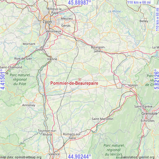
Pommier-de-Beaurepaire GPS coordinates[2]
45° 23' 53.916" North, 5° 7' 5.268" East
| Map corner | latitude | longitude |
|---|---|---|
| Upper-left | 45.88987°, | 4.41501° |
| Center: | 45.39831°, | 5.11813° |
| Lower-right: | 44.90244°, | 5.82126° |
| Map W x H: | 109.8×109.8 km | = 68.2×68.2mi |
| max Lat: | 51.07786° ⇑75.3% North |
| Pommier-de-Beaurepaire: | 45.39831° |
| min Lat: | ⇓24.7% South 41.3874° |
| min Long | Pommier-de-Beau | max Long |
| -5.08615° | 5.11813° | 9.52242° |
| W 78.9%⇐ | ⇒21.1% E |
Elevation
Elevation of Pommier-de-Beaurepaire is 360 m = 1181 ft, and this is 166.3 m = 546 ft above average elevation for this country.
| Max E: |
2333 m = 7654 ft | 14% |
| Pommier-de-Beaurepaire | 360 m 1181 ft | |
| Avg. | 193.7 m = 635 ft | |
Min E: |
-1 m = -3 ft | 86% |
See also: France elevation on elevation.city.
Geographical zone
Pommier-de-Beaurepaire is located in North temperate zone (between Tropic of Cancer and the Arctic Circle). Distance of this North polar circle is 2353.4 km =1462.3 mi to North.| Distance of | km | miles | from Pommier-de-Beaurepaire |
|---|---|---|---|
| North Pole | 4959.2 | 3081.5 | to North |
| Arctic Circle | 2353.4 | 1462.3 | to North |
| Tropic Cancer | 2441.9 | 1517.3 | to South |
| Equator | 5047.8 | 3136.6 | to South |


Nearby cities:
15 places around Pommier-de-Beaurepaire: (largest is in red/bold)
• Beaurepaire
8.7 km =5.4 mi,  218°
218°
• Commelle
9 km =5.6 mi,  68°
68°
• Cour-et-Buis
10 km =6.2 mi,  298°
298°
• Faramans
3.8 km =2.4 mi,  99°
99°
• Marcilloles
7.9 km =4.9 mi,  140°
140°
• Marcollin
10.7 km =6.6 mi,  195°
195°
• Meyssiez
9.1 km =5.7 mi,  328°
328°
• Moissieu-sur-Dolon
10.1 km =6.3 mi,  262°
262°
• Pajay
4.2 km =2.6 mi,  161°
161°
• Pisieu
4.6 km =2.9 mi,  254°
254°
• Primarette
7 km =4.3 mi,  272°
272°
• Revel
6.8 km =4.2 mi, 254°
• Sardieu
8 km =5 mi,  114°
114°
• Thodure
9.9 km =6.2 mi, 156°
• Villeneuve-de-Marc
8.9 km =5.5 mi,  351°
351°
Sources, notices
• [Note1] Compared only with cities in France existing in our database
• [Src1] Map data: © OpenStreetMap contributors (CC-BY-SA)
• [Src2] Other city data from geonames.org with taken over terms of usage.
• [Src3] Geographical zone / Annual Mean Temperature by Robert A. Rohde @ Wikipedia
