Thodure geodata
Thodure (Auvergne-Rhône-Alpes) is a populated place; located in France in Europe/Paris (GMT+2) time zone. With population of 643 people, there are 12632 cities with bigger population in this country. Compared to other cities in France, 76.2% of cities are located further ↑North; 79.4% of cities are located further ←West and 83.5% of cities have lower elevation than Thodure. Note1
Administrative division(s):
- Level 1: Auvergne-Rhône-Alpes
- Level 2: Département de l'Isère
- Level 3: Arrondissement de Vienne
- Level 4: Thodure


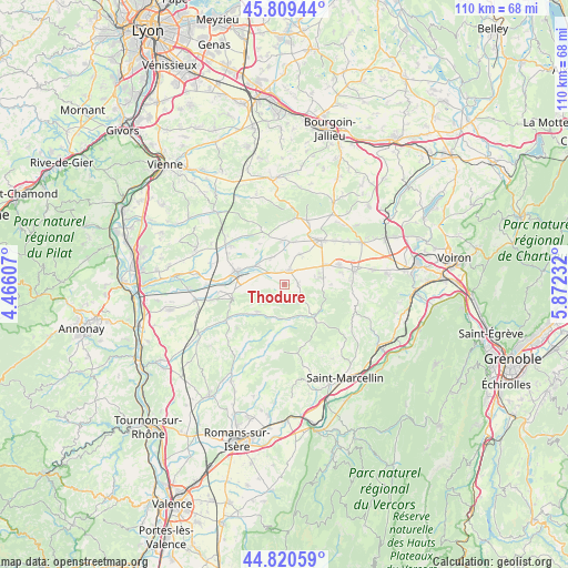
Thodure GPS coordinates[2]
45° 19' 1.812" North, 5° 10' 9.084" East
| Map corner | latitude | longitude |
|---|---|---|
| Upper-left | 45.80944°, | 4.46607° |
| Center: | 45.31717°, | 5.16919° |
| Lower-right: | 44.82059°, | 5.87232° |
| Map W x H: | 109.9×109.9 km | = 68.3×68.3mi |
| max Lat: | 51.07786° ⇑76.2% North |
| Thodure: | 45.31717° |
| min Lat: | ⇓23.8% South 41.3874° |
| min Long | Thodure | max Long |
| -5.08615° | 5.16919° | 9.52242° |
| W 79.4%⇐ | ⇒20.6% E |
Elevation
Elevation of Thodure is 328 m = 1076 ft, and this is 134.3 m = 441 ft above average elevation for this country.
| Max E: |
2333 m = 7654 ft | 16.5% |
| Thodure | 328 m 1076 ft | |
| Avg. | 193.7 m = 635 ft | |
Min E: |
-1 m = -3 ft | 83.5% |
See also: France elevation on elevation.city.
Geographical zone
Thodure is located in North temperate zone (between Tropic of Cancer and the Arctic Circle). Distance of this North polar circle is 2362.4 km =1467.9 mi to North.| Distance of | km | miles | from Thodure |
|---|---|---|---|
| North Pole | 4968.3 | 3087.2 | to North |
| Arctic Circle | 2362.4 | 1467.9 | to North |
| Tropic Cancer | 2432.9 | 1511.7 | to South |
| Equator | 5038.8 | 3131 | to South |


Nearby cities:
15 places around Thodure: (largest is in red/bold)
• Beaurepaire
9.7 km =6 mi,  282°
282°
• Brézins
11.3 km =7 mi,  69°
69°
• Faramans
8.4 km =5.2 mi,  358°
358°
• La Côte-Saint-André
11.1 km =6.9 mi,  39°
39°
• Le Grand-Serre
7.3 km =4.5 mi,  223°
223°
• Lens-Lestang
10.2 km =6.3 mi,  254°
254°
• Marcilloles
3 km =1.9 mi,  19°
19°
• Marcollin
7 km =4.3 mi,  259°
259°
• Pajay
5.7 km =3.5 mi,  332°
332°
• Pommier-de-Beaurepaire
9.9 km =6.2 mi,  336°
336°
• Roybon
8.8 km =5.5 mi,  137°
137°
• Saint-Pierre-de-Bressieux
9.2 km =5.7 mi,  90°
90°
• Saint-Siméon-de-Bressieux
7.9 km =4.9 mi, 72°
• Sardieu
6.6 km =4.1 mi,  30°
30°
• Viriville
2.7 km =1.7 mi, 93°
Sources, notices
• [Note1] Compared only with cities in France existing in our database
• [Src1] Map data: © OpenStreetMap contributors (CC-BY-SA)
• [Src2] Other city data from geonames.org with taken over terms of usage.
• [Src3] Geographical zone / Annual Mean Temperature by Robert A. Rohde @ Wikipedia
