La Roche-Derrien geodata
La Roche-Derrien (Brittany) is a populated place; located in France in Europe/Paris (GMT+2) time zone. With population of 1,063 people, there are 8380 cities with bigger population in this country. Compared to other cities in France, 74.2% of cities are located further ↓South; 97.9% of cities are located further →East and 91.6% of cities have higher elevation than La Roche-Derrien. Note1
Administrative division(s):
- Level 1: Brittany
- Level 2: Département des Côtes-d’Armor
- Level 3: Arrondissement de Lannion
- Level 4: La Roche-Jaudy


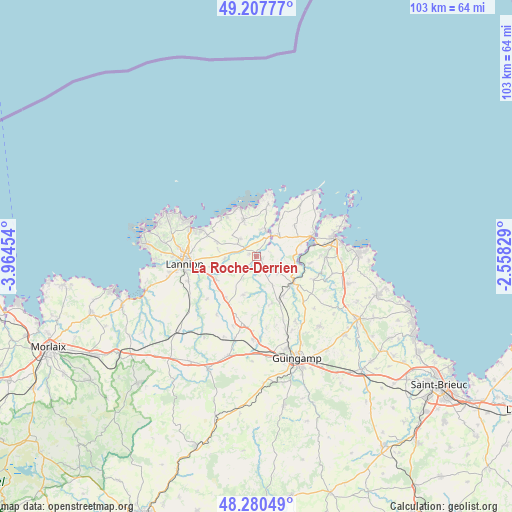
La Roche-Derrien GPS coordinates[2]
48° 44' 46.572" North, 3° 15' 41.112" West
| Map corner | latitude | longitude |
|---|---|---|
| Upper-left | 49.20777°, | -3.96454° |
| Center: | 48.74627°, | -3.26142° |
| Lower-right: | 48.28049°, | -2.55829° |
| Map W x H: | 103.1×103.1 km | = 64.1×64.1mi |
| max Lat: | 51.07786° ⇑25.8% North |
| La Roche-Derrien: | 48.74627° |
| min Lat: | ⇓74.2% South 41.3874° |
| min Long | La Roche-Derrie | max Long |
| -5.08615° | -3.26142° | 9.52242° |
| W 2.1%⇐ | ⇒97.9% E |
Elevation
Elevation of La Roche-Derrien is 26 m = 85 ft, and this is 167.7 m = 550 ft below average elevation for this country.
| Max E: |
2333 m = 7654 ft | 91.6% |
| Avg. | 193.7 m = 635 ft | |
| La Roche-Derrien | 26 m = 85 ft | |
Min E: |
-1 m = -3 ft | 8.4% |
See also: France elevation on elevation.city.
Geographical zone
La Roche-Derrien is located in North temperate zone (between Tropic of Cancer and the Arctic Circle). Distance of this North polar circle is 1981.1 km =1231 mi to North.| Distance of | km | miles | from La Roche-Derrien |
|---|---|---|---|
| North Pole | 4587 | 2850.2 | to North |
| Arctic Circle | 1981.1 | 1231 | to North |
| Tropic Cancer | 2814.2 | 1748.7 | to South |
| Equator | 5420.1 | 3367.9 | to South |


Nearby cities:
15 places around La Roche-Derrien: (largest is in red/bold)
• Camlez
4.7 km =2.9 mi,  318°
318°
• Kermaria-Sulard
8.5 km =5.3 mi,  289°
289°
• Langoat
1.5 km =0.9 mi, 288°
• Minihy-Tréguier
4.2 km =2.6 mi,  34°
34°
• Penvénan
7.7 km =4.8 mi,  341°
341°
• Pleudaniel
9.2 km =5.7 mi,  75°
75°
• Plouguiel
5.9 km =3.7 mi,  16°
16°
• Plouëc-du-Trieux
8.3 km =5.2 mi,  147°
147°
• Ploëzal
5.5 km =3.4 mi,  128°
128°
• Pommerit-Jaudy
2.2 km =1.4 mi,  140°
140°
• Pontrieux
9 km =5.6 mi,  123°
123°
• Prat
8.2 km =5.1 mi,  198°
198°
• Rospez
9.2 km =5.7 mi,  258°
258°
• Trédarzec
6.2 km =3.9 mi,  45°
45°
• Tréguier
4.6 km =2.9 mi, 26°
Sources, notices
• [Note1] Compared only with cities in France existing in our database
• [Src1] Map data: © OpenStreetMap contributors (CC-BY-SA)
• [Src2] Other city data from geonames.org with taken over terms of usage.
• [Src3] Geographical zone / Annual Mean Temperature by Robert A. Rohde @ Wikipedia
