Poligné geodata
Poligné (Brittany) is a populated place; located in France in Europe/Paris (GMT+2) time zone. With population of 830 people, there are 10289 cities with bigger population in this country. Compared to other cities in France, 57.3% of cities are located further ↓South; 93.4% of cities are located further →East and 75.4% of cities have higher elevation than Poligné. Note1
Administrative division(s):
- Level 1: Brittany
- Level 2: Département d'Ille-et-Vilaine
- Level 3: Arrondissement de Redon
- Level 4: Poligné


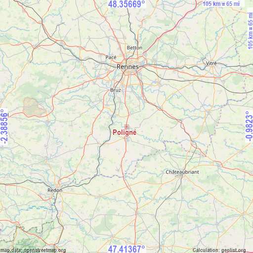
Poligné GPS coordinates[2]
47° 53' 14.388" North, 1° 41' 7.548" West
| Map corner | latitude | longitude |
|---|---|---|
| Upper-left | 48.35669°, | -2.38856° |
| Center: | 47.88733°, | -1.68543° |
| Lower-right: | 47.41367°, | -0.9823° |
| Map W x H: | 104.9×104.9 km | = 65.2×65.2mi |
| max Lat: | 51.07786° ⇑42.7% North |
| Poligné: | 47.88733° |
| min Lat: | ⇓57.3% South 41.3874° |
| min Long | Poligné | max Long |
| -5.08615° | -1.68543° | 9.52242° |
| W 6.6%⇐ | ⇒93.4% E |
Elevation
Elevation of Poligné is 66 m = 217 ft, and this is 127.7 m = 419 ft below average elevation for this country.
| Max E: |
2333 m = 7654 ft | 75.4% |
| Avg. | 193.7 m = 635 ft | |
| Poligné | 66 m = 217 ft | |
Min E: |
-1 m = -3 ft | 24.6% |
See also: France elevation on elevation.city.
Geographical zone
Poligné is located in North temperate zone (between Tropic of Cancer and the Arctic Circle). Distance of this North polar circle is 2076.6 km =1290.3 mi to North.| Distance of | km | miles | from Poligné |
|---|---|---|---|
| North Pole | 4682.5 | 2909.6 | to North |
| Arctic Circle | 2076.6 | 1290.3 | to North |
| Tropic Cancer | 2718.7 | 1689.3 | to South |
| Equator | 5324.6 | 3308.6 | to South |


Nearby cities:
15 places around Poligné: (largest is in red/bold)
• Bain-de-Bretagne
4.8 km =3 mi,  179°
179°
• Bourg-des-Comptes
6.5 km =4 mi,  316°
316°
• Chanteloup
10.2 km =6.3 mi,  30°
30°
• Crevin
5.3 km =3.3 mi,  15°
15°
• Ercé-en-Lamée
11.4 km =7.1 mi,  123°
123°
• La Noë-Blanche
10.2 km =6.3 mi,  204°
204°
• Laillé
10.4 km =6.5 mi,  347°
347°
• Le Petit-Fougeray
7.3 km =4.5 mi,  52°
52°
• Le Sel-de-Bretagne
5.3 km =3.3 mi,  74°
74°
• Pancé
2 km =1.2 mi,  107°
107°
• Pléchâtel
4.8 km =3 mi,  280°
280°
• Saint-Malo-de-Phily
7.7 km =4.8 mi,  261°
261°
• Saint-Senoux
7.9 km =4.9 mi, 284°
• Saulnières
8.1 km =5 mi, 67°
• Tresbœuf
10.1 km =6.3 mi,  92°
92°
Sources, notices
• [Note1] Compared only with cities in France existing in our database
• [Src1] Map data: © OpenStreetMap contributors (CC-BY-SA)
• [Src2] Other city data from geonames.org with taken over terms of usage.
• [Src3] Geographical zone / Annual Mean Temperature by Robert A. Rohde @ Wikipedia
