La Noë-Blanche geodata
La Noë-Blanche (Brittany) is a populated place; located in France in Europe/Paris (GMT+2) time zone. With population of 905 people, there are 9610 cities with bigger population in this country. Compared to other cities in France, 55.8% of cities are located further ↓South; 93.7% of cities are located further →East and 80.2% of cities have higher elevation than La Noë-Blanche. Note1
Administrative division(s):
- Level 1: Brittany
- Level 2: Département d'Ille-et-Vilaine
- Level 3: Arrondissement de Redon
- Level 4: La Noë-Blanche


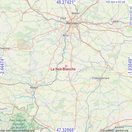
La Noë-Blanche GPS coordinates[2]
47° 48' 14.724" North, 1° 44' 29.796" West
| Map corner | latitude | longitude |
|---|---|---|
| Upper-left | 48.27421°, | -2.44474° |
| Center: | 47.80409°, | -1.74161° |
| Lower-right: | 47.32968°, | -1.03849° |
| Map W x H: | 105×105 km | = 65.2×65.2mi |
| max Lat: | 51.07786° ⇑44.2% North |
| La Noë-Blanche: | 47.80409° |
| min Lat: | ⇓55.8% South 41.3874° |
| min Long | La Noë-Blanche | max Long |
| -5.08615° | -1.74161° | 9.52242° |
| W 6.3%⇐ | ⇒93.7% E |
Elevation
Elevation of La Noë-Blanche is 54 m = 177 ft, and this is 139.7 m = 458 ft below average elevation for this country.
| Max E: |
2333 m = 7654 ft | 80.2% |
| Avg. | 193.7 m = 635 ft | |
| La Noë-Blanche | 54 m = 177 ft | |
Min E: |
-1 m = -3 ft | 19.8% |
See also: France elevation on elevation.city.
Geographical zone
La Noë-Blanche is located in North temperate zone (between Tropic of Cancer and the Arctic Circle). Distance of this North polar circle is 2085.9 km =1296.1 mi to North.| Distance of | km | miles | from La Noë-Blanche |
|---|---|---|---|
| North Pole | 4691.7 | 2915.3 | to North |
| Arctic Circle | 2085.9 | 1296.1 | to North |
| Tropic Cancer | 2709.4 | 1683.5 | to South |
| Equator | 5315.3 | 3302.8 | to South |


Nearby cities:
15 places around La Noë-Blanche: (largest is in red/bold)
• Bain-de-Bretagne
6.1 km =3.8 mi,  43°
43°
• Grand-Fougeray
8.9 km =5.5 mi,  175°
175°
• Guipry
7.9 km =4.9 mi,  288°
288°
• La Dominelais
6.1 km =3.8 mi,  139°
139°
• Langon
12.3 km =7.6 mi,  221°
221°
• Lohéac
12.7 km =7.9 mi,  303°
303°
• Messac
5.6 km =3.5 mi, 293°
• Pancé
10.6 km =6.6 mi, 35°
• Pierric
13.1 km =8.1 mi, 178°
• Pléchâtel
10.1 km =6.3 mi,  356°
356°
• Poligné
10.2 km =6.3 mi,  24°
24°
• Saint-Malo-de-Phily
8.8 km =5.5 mi,  336°
336°
• Saint-Senoux
11.8 km =7.3 mi, 342°
• Sainte-Anne-sur-Vilaine
10.3 km =6.4 mi, 217°
• Sion-les-Mines
13.6 km =8.5 mi,  124°
124°
Sources, notices
• [Note1] Compared only with cities in France existing in our database
• [Src1] Map data: © OpenStreetMap contributors (CC-BY-SA)
• [Src2] Other city data from geonames.org with taken over terms of usage.
• [Src3] Geographical zone / Annual Mean Temperature by Robert A. Rohde @ Wikipedia
