Plusquellec geodata
Plusquellec (Brittany) is a populated place; located in France in Europe/Paris (GMT+2) time zone. With population of 554 people, there are 14131 cities with bigger population in this country. Compared to other cities in France, 66% of cities are located further ↓South; 98.3% of cities are located further →East and 58.9% of cities have lower elevation than Plusquellec. Note1
Administrative division(s):
- Level 1: Brittany
- Level 2: Département des Côtes-d’Armor
- Level 3: Arrondissement de Guingamp
- Level 4: Plusquellec


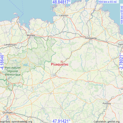
Plusquellec GPS coordinates[2]
48° 22' 59.988" North, 3° 28' 59.988" West
| Map corner | latitude | longitude |
|---|---|---|
| Upper-left | 48.84817°, | -4.18646° |
| Center: | 48.38333°, | -3.48333° |
| Lower-right: | 47.91421°, | -2.78021° |
| Map W x H: | 103.8×103.8 km | = 64.5×64.5mi |
| max Lat: | 51.07786° ⇑34% North |
| Plusquellec: | 48.38333° |
| min Lat: | ⇓66% South 41.3874° |
| min Long | Plusquellec | max Long |
| -5.08615° | -3.48333° | 9.52242° |
| W 1.7%⇐ | ⇒98.3% E |
Elevation
Elevation of Plusquellec is 165 m = 541 ft, and this is 28.7 m = 94 ft below average elevation for this country.
| Max E: |
2333 m = 7654 ft | 41.1% |
| Avg. | 193.7 m = 635 ft | |
| Plusquellec | 165 m = 541 ft | |
Min E: |
-1 m = -3 ft | 58.9% |
See also: France elevation on elevation.city.
Geographical zone
Plusquellec is located in North temperate zone (between Tropic of Cancer and the Arctic Circle). Distance of this North polar circle is 2021.5 km =1256.1 mi to North.| Distance of | km | miles | from Plusquellec |
|---|---|---|---|
| North Pole | 4627.3 | 2875.3 | to North |
| Arctic Circle | 2021.5 | 1256.1 | to North |
| Tropic Cancer | 2773.8 | 1723.6 | to South |
| Equator | 5379.7 | 3342.8 | to South |


Nearby cities:
15 places around Plusquellec: (largest is in red/bold)
• Callac
4.6 km =2.9 mi,  61°
61°
• Carhaix-Plouguer
13.7 km =8.5 mi,  209°
209°
• Carnoët
3.3 km =2.1 mi,  237°
237°
• Kergloff
15.9 km =9.9 mi,  220°
220°
• Kergrist-Moëlou
14.7 km =9.1 mi,  123°
123°
• Le Moustoir
13 km =8.1 mi,  187°
187°
• Loguivy-Plougras
15.5 km =9.6 mi,  358°
358°
• Maël-Carhaix
11.9 km =7.4 mi,  157°
157°
• Plougonver
13.6 km =8.5 mi,  34°
34°
• Plounévézel
12.7 km =7.9 mi, 222°
• Pont-Melvez
15.6 km =9.7 mi, 56°
• Poullaouen
13.5 km =8.4 mi,  245°
245°
• Scrignac
15.4 km =9.6 mi,  291°
291°
• Treffrin
9.6 km =6 mi, 194°
• Trébrivan
7.4 km =4.6 mi,  180°
180°
Sources, notices
• [Note1] Compared only with cities in France existing in our database
• [Src1] Map data: © OpenStreetMap contributors (CC-BY-SA)
• [Src2] Other city data from geonames.org with taken over terms of usage.
• [Src3] Geographical zone / Annual Mean Temperature by Robert A. Rohde @ Wikipedia
