La Roche-Maurice geodata
La Roche-Maurice (Brittany) is a populated place; located in France in Europe/Paris (GMT+2) time zone. With population of 1,791 people, there are 5301 cities with bigger population in this country. Compared to other cities in France, 67.8% of cities are located further ↓South; 99.3% of cities are located further →East and 93.6% of cities have higher elevation than La Roche-Maurice. Note1
Administrative division(s):
- Level 1: Brittany
- Level 2: Département du Finistère
- Level 3: Arrondissement de Brest
- Level 4: La Roche-Maurice


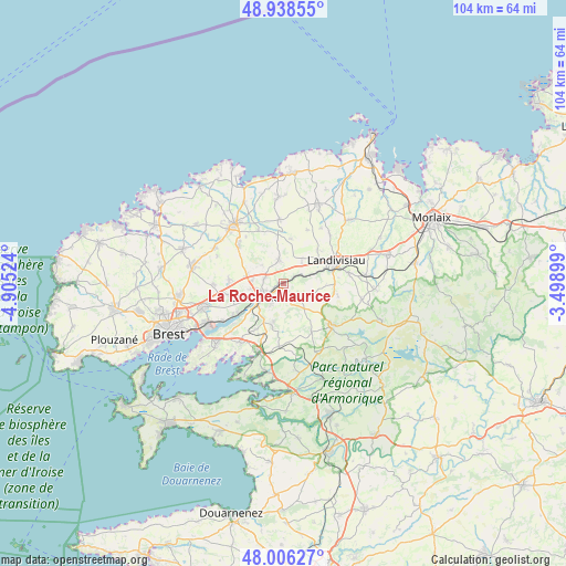
La Roche-Maurice GPS coordinates[2]
48° 28' 28.38" North, 4° 12' 7.596" West
| Map corner | latitude | longitude |
|---|---|---|
| Upper-left | 48.93855°, | -4.90524° |
| Center: | 48.47455°, | -4.20211° |
| Lower-right: | 48.00627°, | -3.49899° |
| Map W x H: | 103.7×103.7 km | = 64.4×64.4mi |
| max Lat: | 51.07786° ⇑32.2% North |
| La Roche-Maurice: | 48.47455° |
| min Lat: | ⇓67.8% South 41.3874° |
| min Long | La Roche-Mauric | max Long |
| -5.08615° | -4.20211° | 9.52242° |
| W 0.7%⇐ | ⇒99.3% E |
Elevation
Elevation of La Roche-Maurice is 21 m = 69 ft, and this is 172.7 m = 567 ft below average elevation for this country.
| Max E: |
2333 m = 7654 ft | 93.6% |
| Avg. | 193.7 m = 635 ft | |
| La Roche-Maurice | 21 m = 69 ft | |
Min E: |
-1 m = -3 ft | 6.4% |
See also: France elevation on elevation.city.
Geographical zone
La Roche-Maurice is located in North temperate zone (between Tropic of Cancer and the Arctic Circle). Distance of this North polar circle is 2011.3 km =1249.8 mi to North.| Distance of | km | miles | from La Roche-Maurice |
|---|---|---|---|
| North Pole | 4617.2 | 2869 | to North |
| Arctic Circle | 2011.3 | 1249.8 | to North |
| Tropic Cancer | 2783.9 | 1729.8 | to South |
| Equator | 5389.9 | 3349.1 | to South |


Nearby cities:
15 places around La Roche-Maurice: (largest is in red/bold)
• Bodilis
8.8 km =5.5 mi,  46°
46°
• Dirinon
9.9 km =6.2 mi,  210°
210°
• La Forest-Landerneau
10 km =6.2 mi,  237°
237°
• La Martyre
4.3 km =2.7 mi,  132°
132°
• Landerneau
4.5 km =2.8 mi, 236°
• Landivisiau
10.5 km =6.5 mi,  69°
69°
• Pencran
5.1 km =3.2 mi, 206°
• Ploudaniel
10.7 km =6.6 mi,  307°
307°
• Ploudiry
4.7 km =2.9 mi, 125°
• Plounéventer
4.8 km =3 mi,  347°
347°
• Plouédern
3.7 km =2.3 mi,  285°
285°
• Saint-Derrien
8.5 km =5.3 mi,  9°
9°
• Saint-Servais
6.1 km =3.8 mi,  39°
39°
• Saint-Thonan
9.7 km =6 mi,  275°
275°
• Saint-Urbain
8.6 km =5.3 mi,  195°
195°
Sources, notices
• [Note1] Compared only with cities in France existing in our database
• [Src1] Map data: © OpenStreetMap contributors (CC-BY-SA)
• [Src2] Other city data from geonames.org with taken over terms of usage.
• [Src3] Geographical zone / Annual Mean Temperature by Robert A. Rohde @ Wikipedia
