Plonéis geodata
Plonéis (Brittany) is a populated place; located in France in Europe/Paris (GMT+2) time zone. With population of 1,504 people, there are 6177 cities with bigger population in this country. Compared to other cities in France, 59.5% of cities are located further ↓South; 99.4% of cities are located further →East and 53.6% of cities have lower elevation than Plonéis. Note1
Administrative division(s):
- Level 1: Brittany
- Level 2: Département du Finistère
- Level 3: Arrondissement de Quimper
- Level 4: Plonéis


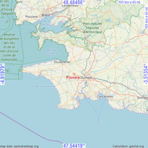
Plonéis GPS coordinates[2]
48° 1' 0.012" North, 4° 13' 0.012" West
| Map corner | latitude | longitude |
|---|---|---|
| Upper-left | 48.48486°, | -4.91979° |
| Center: | 48.01667°, | -4.21667° |
| Lower-right: | 47.54419°, | -3.51354° |
| Map W x H: | 104.6×104.6 km | = 65×65mi |
| max Lat: | 51.07786° ⇑40.5% North |
| Plonéis: | 48.01667° |
| min Lat: | ⇓59.5% South 41.3874° |
| min Long | Plonéis | max Long |
| -5.08615° | -4.21667° | 9.52242° |
| W 0.6%⇐ | ⇒99.4% E |
Elevation
Elevation of Plonéis is 145 m = 476 ft, and this is 48.7 m = 160 ft below average elevation for this country.
| Max E: |
2333 m = 7654 ft | 46.4% |
| Avg. | 193.7 m = 635 ft | |
| Plonéis | 145 m = 476 ft | |
Min E: |
-1 m = -3 ft | 53.6% |
See also: France elevation on elevation.city.
Geographical zone
Plonéis is located in North temperate zone (between Tropic of Cancer and the Arctic Circle). Distance of this North polar circle is 2062.2 km =1281.4 mi to North.| Distance of | km | miles | from Plonéis |
|---|---|---|---|
| North Pole | 4668.1 | 2900.6 | to North |
| Arctic Circle | 2062.2 | 1281.4 | to North |
| Tropic Cancer | 2733 | 1698.2 | to South |
| Equator | 5339 | 3317.5 | to South |


Nearby cities:
15 places around Plonéis: (largest is in red/bold)
• Douarnenez
12.1 km =7.5 mi,  316°
316°
• Gourlizon
3.7 km =2.3 mi,  273°
273°
• Guengat
2.9 km =1.8 mi,  17°
17°
• Kerlaz
9.2 km =5.7 mi,  333°
333°
• Landudec
9.1 km =5.7 mi,  258°
258°
• Le Juch
6.2 km =3.9 mi, 332°
• Locronan
9.2 km =5.7 mi,  4°
4°
• Peumerit
11 km =6.8 mi,  218°
218°
• Plogastel-Saint-Germain
5.3 km =3.3 mi,  225°
225°
• Plogonnec
7.8 km =4.8 mi, 18°
• Plomelin
10.5 km =6.5 mi,  151°
151°
• Plonévez-Porzay
9.3 km =5.8 mi, 0°
• Pluguffan
4.5 km =2.8 mi, 146°
• Pouldergat
9.4 km =5.8 mi,  293°
293°
• Quimper
8.9 km =5.5 mi,  102°
102°
Sources, notices
• [Note1] Compared only with cities in France existing in our database
• [Src1] Map data: © OpenStreetMap contributors (CC-BY-SA)
• [Src2] Other city data from geonames.org with taken over terms of usage.
• [Src3] Geographical zone / Annual Mean Temperature by Robert A. Rohde @ Wikipedia
