Pleumartin geodata
Pleumartin (Nouvelle-Aquitaine) is a populated place; located in France in Europe/Paris (GMT+2) time zone. With population of 1,196 people, there are 7557 cities with bigger population in this country. Compared to other cities in France, 57.8% of cities are located further ↑North; 70.8% of cities are located further →East and 51.4% of cities have lower elevation than Pleumartin. Note1
Administrative division(s):
- Level 1: Nouvelle-Aquitaine
- Level 2: Vienne
- Level 3: Arrondissement de Châtellerault
- Level 4: Pleumartin


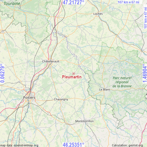
Pleumartin GPS coordinates[2]
46° 44' 15.144" North, 0° 45' 57.312" East
| Map corner | latitude | longitude |
|---|---|---|
| Upper-left | 47.21727°, | 0.06279° |
| Center: | 46.73754°, | 0.76592° |
| Lower-right: | 46.25351°, | 1.46904° |
| Map W x H: | 107.2×107.2 km | = 66.6×66.6mi |
| max Lat: | 51.07786° ⇑57.8% North |
| Pleumartin: | 46.73754° |
| min Lat: | ⇓42.2% South 41.3874° |
| min Long | Pleumartin | max Long |
| -5.08615° | 0.76592° | 9.52242° |
| W 29.2%⇐ | ⇒70.8% E |
Elevation
Elevation of Pleumartin is 137 m = 449 ft, and this is 56.7 m = 186 ft below average elevation for this country.
| Max E: |
2333 m = 7654 ft | 48.6% |
| Avg. | 193.7 m = 635 ft | |
| Pleumartin | 137 m = 449 ft | |
Min E: |
-1 m = -3 ft | 51.4% |
See also: France elevation on elevation.city.
Geographical zone
Pleumartin is located in North temperate zone (between Tropic of Cancer and the Arctic Circle). Distance of this North polar circle is 2204.4 km =1369.8 mi to North.| Distance of | km | miles | from Pleumartin |
|---|---|---|---|
| North Pole | 4810.3 | 2989 | to North |
| Arctic Circle | 2204.4 | 1369.8 | to North |
| Tropic Cancer | 2590.8 | 1609.8 | to South |
| Equator | 5196.7 | 3229.1 | to South |


Nearby cities:
15 places around Pleumartin: (largest is in red/bold)
• Archigny
11.2 km =7 mi,  230°
230°
• Barrou
14.3 km =8.9 mi,  1°
1°
• Bonneuil-Matours
16.2 km =10.1 mi,  247°
247°
• Coussay-les-Bois
8 km =5 mi,  347°
347°
• La Puye
10.6 km =6.6 mi,  185°
185°
• La Roche-Posay
6.5 km =4 mi,  32°
32°
• Lésigny
12.4 km =7.7 mi, 0°
• Monthoiron
11.2 km =7 mi,  267°
267°
• Saint-Pierre-de-Maillé
8.8 km =5.5 mi,  137°
137°
• Saint-Sauveur
13.4 km =8.3 mi,  305°
305°
• Senillé
12.4 km =7.7 mi,  291°
291°
• Tournon-Saint-Martin
14.4 km =8.9 mi,  91°
91°
• Tournon-Saint-Pierre
14.2 km =8.8 mi, 89°
• Vicq-sur-Gartempe
7.5 km =4.7 mi,  103°
103°
• Yzeures-sur-Creuse
9.7 km =6 mi,  56°
56°
Sources, notices
• [Note1] Compared only with cities in France existing in our database
• [Src1] Map data: © OpenStreetMap contributors (CC-BY-SA)
• [Src2] Other city data from geonames.org with taken over terms of usage.
• [Src3] Geographical zone / Annual Mean Temperature by Robert A. Rohde @ Wikipedia
