La Roche-Posay geodata
La Roche-Posay (Nouvelle-Aquitaine) is a populated place; located in France in Europe/Paris (GMT+2) time zone. With population of 1,553 people, there are 6002 cities with bigger population in this country. Compared to other cities in France, 57.3% of cities are located further ↑North; 70.4% of cities are located further →East and 78.2% of cities have higher elevation than La Roche-Posay. Note1
Administrative division(s):
- Level 1: Nouvelle-Aquitaine
- Level 2: Vienne
- Level 3: Arrondissement de Châtellerault
- Level 4: La Roche-Posay


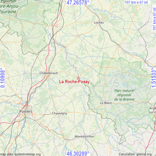
La Roche-Posay GPS coordinates[2]
46° 47' 11.364" North, 0° 48' 43.92" East
| Map corner | latitude | longitude |
|---|---|---|
| Upper-left | 47.26578°, | 0.10908° |
| Center: | 46.78649°, | 0.8122° |
| Lower-right: | 46.30289°, | 1.51533° |
| Map W x H: | 107.1×107.1 km | = 66.5×66.5mi |
| max Lat: | 51.07786° ⇑57.3% North |
| La Roche-Posay: | 46.78649° |
| min Lat: | ⇓42.7% South 41.3874° |
| min Long | La Roche-Posay | max Long |
| -5.08615° | 0.8122° | 9.52242° |
| W 29.6%⇐ | ⇒70.4% E |
Elevation
Elevation of La Roche-Posay is 59 m = 194 ft, and this is 134.7 m = 442 ft below average elevation for this country.
| Max E: |
2333 m = 7654 ft | 78.2% |
| Avg. | 193.7 m = 635 ft | |
| La Roche-Posay | 59 m = 194 ft | |
Min E: |
-1 m = -3 ft | 21.8% |
See also: France elevation on elevation.city.
Geographical zone
La Roche-Posay is located in North temperate zone (between Tropic of Cancer and the Arctic Circle). Distance of this North polar circle is 2199 km =1366.4 mi to North.| Distance of | km | miles | from La Roche-Posay |
|---|---|---|---|
| North Pole | 4804.9 | 2985.6 | to North |
| Arctic Circle | 2199 | 1366.4 | to North |
| Tropic Cancer | 2596.3 | 1613.3 | to South |
| Equator | 5202.2 | 3232.5 | to South |


Nearby cities:
15 places around La Roche-Posay: (largest is in red/bold)
• Barrou
9.5 km =5.9 mi,  339°
339°
• Bossay-sur-Claise
12.4 km =7.7 mi,  66°
66°
• Coussay-les-Bois
5.8 km =3.6 mi,  294°
294°
• Le Grand-Pressigny
14.9 km =9.3 mi,  357°
357°
• Lésigny
7.8 km =4.8 mi,  333°
333°
• Monthoiron
15.9 km =9.9 mi,  248°
248°
• Pleumartin
6.5 km =4 mi,  212°
212°
• Preuilly-sur-Claise
11.7 km =7.3 mi,  49°
49°
• Saint-Pierre-de-Maillé
12.2 km =7.6 mi,  168°
168°
• Saint-Sauveur
14.6 km =9.1 mi,  279°
279°
• Senillé
15.1 km =9.4 mi,  266°
266°
• Tournon-Saint-Martin
12.3 km =7.6 mi,  118°
118°
• Tournon-Saint-Pierre
11.9 km =7.4 mi, 116°
• Vicq-sur-Gartempe
8.2 km =5.1 mi,  152°
152°
• Yzeures-sur-Creuse
4.5 km =2.8 mi,  90°
90°
Sources, notices
• [Note1] Compared only with cities in France existing in our database
• [Src1] Map data: © OpenStreetMap contributors (CC-BY-SA)
• [Src2] Other city data from geonames.org with taken over terms of usage.
• [Src3] Geographical zone / Annual Mean Temperature by Robert A. Rohde @ Wikipedia
