Plerguer geodata
Plerguer (Brittany) is a populated place; located in France in Europe/Paris (GMT+2) time zone. With population of 1,967 people, there are 4864 cities with bigger population in this country. Compared to other cities in France, 69% of cities are located further ↓South; 94.3% of cities are located further →East and 89.9% of cities have higher elevation than Plerguer. Note1
Administrative division(s):
- Level 1: Brittany
- Level 2: Département d'Ille-et-Vilaine
- Level 3: Arrondissement de Saint-Malo
- Level 4: Plerguer


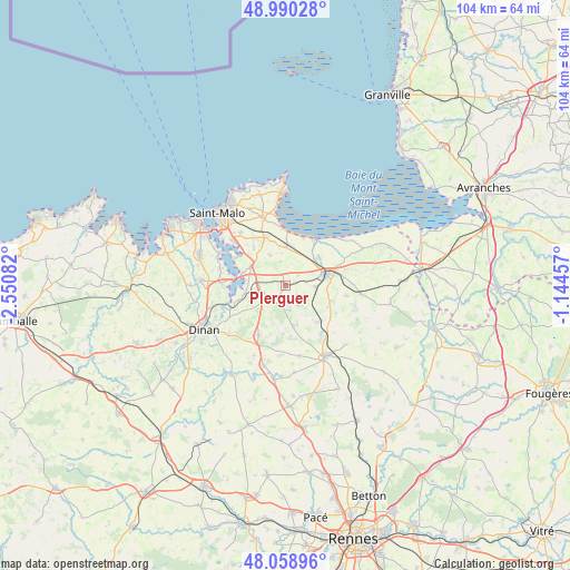
Plerguer GPS coordinates[2]
48° 31' 36.336" North, 1° 50' 51.684" West
| Map corner | latitude | longitude |
|---|---|---|
| Upper-left | 48.99028°, | -2.55082° |
| Center: | 48.52676°, | -1.84769° |
| Lower-right: | 48.05896°, | -1.14457° |
| Map W x H: | 103.6×103.6 km | = 64.4×64.4mi |
| max Lat: | 51.07786° ⇑31% North |
| Plerguer: | 48.52676° |
| min Lat: | ⇓69% South 41.3874° |
| min Long | Plerguer | max Long |
| -5.08615° | -1.84769° | 9.52242° |
| W 5.7%⇐ | ⇒94.3% E |
Elevation
Elevation of Plerguer is 30 m = 98 ft, and this is 163.7 m = 537 ft below average elevation for this country.
| Max E: |
2333 m = 7654 ft | 89.9% |
| Avg. | 193.7 m = 635 ft | |
| Plerguer | 30 m = 98 ft | |
Min E: |
-1 m = -3 ft | 10.1% |
See also: France elevation on elevation.city.
Geographical zone
Plerguer is located in North temperate zone (between Tropic of Cancer and the Arctic Circle). Distance of this North polar circle is 2005.5 km =1246.2 mi to North.| Distance of | km | miles | from Plerguer |
|---|---|---|---|
| North Pole | 4611.4 | 2865.4 | to North |
| Arctic Circle | 2005.5 | 1246.2 | to North |
| Tropic Cancer | 2789.8 | 1733.5 | to South |
| Equator | 5395.7 | 3352.7 | to South |


Nearby cities:
15 places around Plerguer: (largest is in red/bold)
• Baguer-Morvan
5.5 km =3.4 mi,  91°
91°
• Bonnemain
8.9 km =5.5 mi,  138°
138°
• Châteauneuf-d’Ille-et-Vilaine
7 km =4.3 mi,  302°
302°
• Dol-de-Bretagne
7.5 km =4.7 mi,  72°
72°
• Hirel
9.3 km =5.8 mi,  21°
21°
• La Fresnais
7.6 km =4.7 mi,  3°
3°
• La Gouesnière
9.3 km =5.8 mi,  338°
338°
• La Ville-ès-Nonais
8 km =5 mi,  286°
286°
• Lanhélin
7.8 km =4.8 mi,  169°
169°
• Le Tronchet
4.6 km =2.9 mi, 169°
• Miniac-Morvan
4 km =2.5 mi,  250°
250°
• Pleudihen-sur-Rance
8.8 km =5.5 mi,  262°
262°
• Roz-Landrieux
3 km =1.9 mi,  51°
51°
• Saint-Guinoux
6 km =3.7 mi,  333°
333°
• Saint-Père
8.8 km =5.5 mi,  320°
320°
Sources, notices
• [Note1] Compared only with cities in France existing in our database
• [Src1] Map data: © OpenStreetMap contributors (CC-BY-SA)
• [Src2] Other city data from geonames.org with taken over terms of usage.
• [Src3] Geographical zone / Annual Mean Temperature by Robert A. Rohde @ Wikipedia
