Pleine-Fougères geodata
Pleine-Fougères (Brittany) is a populated place; located in France in Europe/Paris (GMT+2) time zone. With population of 1,795 people, there are 5290 cities with bigger population in this country. Compared to other cities in France, 69.1% of cities are located further ↓South; 92.7% of cities are located further →East and 86.2% of cities have higher elevation than Pleine-Fougères. Note1
Administrative division(s):
- Level 1: Brittany
- Level 2: Département d'Ille-et-Vilaine
- Level 3: Arrondissement de Saint-Malo
- Level 4: Pleine-Fougères


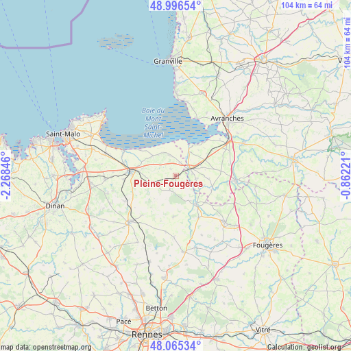
Pleine-Fougères GPS coordinates[2]
48° 31' 59.088" North, 1° 33' 55.224" West
| Map corner | latitude | longitude |
|---|---|---|
| Upper-left | 48.99654°, | -2.26846° |
| Center: | 48.53308°, | -1.56534° |
| Lower-right: | 48.06534°, | -0.86221° |
| Map W x H: | 103.5×103.5 km | = 64.3×64.3mi |
| max Lat: | 51.07786° ⇑30.9% North |
| Pleine-Fougères: | 48.53308° |
| min Lat: | ⇓69.1% South 41.3874° |
| min Long | Pleine-Fougère | max Long |
| -5.08615° | -1.56534° | 9.52242° |
| W 7.3%⇐ | ⇒92.7% E |
Elevation
Elevation of Pleine-Fougères is 39 m = 128 ft, and this is 154.7 m = 508 ft below average elevation for this country.
| Max E: |
2333 m = 7654 ft | 86.2% |
| Avg. | 193.7 m = 635 ft | |
| Pleine-Fougères | 39 m = 128 ft | |
Min E: |
-1 m = -3 ft | 13.8% |
See also: France elevation on elevation.city.
Geographical zone
Pleine-Fougères is located in North temperate zone (between Tropic of Cancer and the Arctic Circle). Distance of this North polar circle is 2004.8 km =1245.7 mi to North.| Distance of | km | miles | from Pleine-Fougères |
|---|---|---|---|
| North Pole | 4610.7 | 2865 | to North |
| Arctic Circle | 2004.8 | 1245.7 | to North |
| Tropic Cancer | 2790.5 | 1733.9 | to South |
| Equator | 5396.4 | 3353.2 | to South |


Nearby cities:
15 places around Pleine-Fougères: (largest is in red/bold)
• Antrain
10.1 km =6.3 mi,  143°
143°
• Argouges
12.9 km =8 mi,  105°
105°
• Baguer-Pican
10 km =6.2 mi,  282°
282°
• Bazouges-la-Pérouse
11.9 km =7.4 mi,  183°
183°
• Cherrueix
13.1 km =8.1 mi,  308°
308°
• Dol-de-Bretagne
13.7 km =8.5 mi, 276°
• Epiniac
10.6 km =6.6 mi,  249°
249°
• La Boussac
7.4 km =4.6 mi, 252°
• La Fontenelle
8.7 km =5.4 mi,  148°
148°
• Pontorson
4.8 km =3 mi,  62°
62°
• Roz-sur-Couesnon
6.5 km =4 mi,  342°
342°
• Sacey
8.9 km =5.5 mi, 107°
• Saint-Broladre
9 km =5.6 mi, 311°
• Sougéal
4 km =2.5 mi,  129°
129°
• Trans-la-Forêt
4.5 km =2.8 mi,  214°
214°
Sources, notices
• [Note1] Compared only with cities in France existing in our database
• [Src1] Map data: © OpenStreetMap contributors (CC-BY-SA)
• [Src2] Other city data from geonames.org with taken over terms of usage.
• [Src3] Geographical zone / Annual Mean Temperature by Robert A. Rohde @ Wikipedia
